Contemporary Views Along the First Transcontinental Railroad
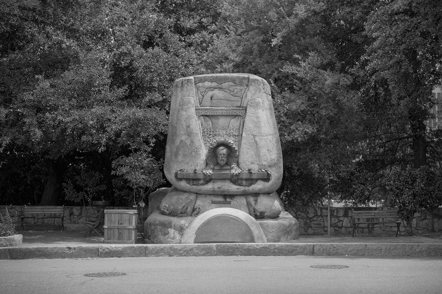
Judah Monument, Old Sacramento, California – This monument was built in the honor of a promising young engineer, Theodore Judah. In addition to being a tireless promoter for the Pacific Railroad in the halls of Congress, he envisioned and then plotted a twisting line that would get the Central Pacific through the Sierra Nevada. Unfortunately, he did not live long enough to see but a few miles of the route with rails spiked to ties.
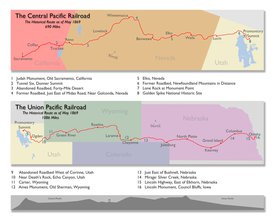
While construction of the Pacific Railroad ostensibly began during the Civil War, it was not until that great conflict was over that it really got rolling. In a race for government subsidies and land grants, the Central Pacific built eastward from Sacramento, California, while the Union Pacific built westward from Omaha, Nebraska. The two railroads met at Promontory Summit, just north of Great Salt Lake, Utah Territory, on May 10th 1869. It was a watershed moment.
I follow in the footsteps of photographers Alfred A. Hart and A. J. Russell who expertly recorded the construction of the road. But this is not a re-photography project—it is, rather, photography as archaeology. In making a comprehensive series of photographs along the original route, my goal is to give the viewer as strong of a connection as possible to this 19th century engineering marvel through the remaining visual evidence of the human-altered landscape. And while not visible, I also hope to evoke the various peoples involved with the railroad, as well as those affected by it.
I have always been drawn to western landscape photographs, particularly the work of Carleton Watkins and Timothy O’Sullivan. I tend to see their imagery as existing on opposite sides of an aesthetic coin—with the former rendering the beautiful and the latter portraying the sublime. These two 18th century linguistic terms, beautiful and sublime (usually considered in relation to one another), were used to categorize one’s emotional response when viewing artwork. Imagery that promoted pleasurable and familiar feelings was referred to as beautiful, while pictures that evoked feelings of awe or terror, often brought on by the immense scale of nature, were referred to as sublime.
The story of the first transcontinental railroad is one of contradictions and oppositional forces not unlike the conceptual inter-relatedness of those two aesthetic terms. The surveyors explored an Eden, but initiated its destruction. The road was a crown jewel of the industrial age, but the actual building, the grading and tunneling, was done almost completely without machines. The railroad conquered time and space, but this led quickly to the decimation of the buffalo which pushed the people who depended upon them to the brink. This was the first transcontinental railroad in North America, or anywhere for that matter. The pounding of the Golden Spike signaled the completion of a great human achievement, but it must have sounded like a death knell to Native Americans. It put a bow on Manifest Destiny and served as a primer for the questionable business practices that would follow in the Gilded Age.
Through modern absence, I find it most easy to imagine a 19th century presence.”
In the end, I want these images to be a pictorial accompaniment to well-established textual histories of the building of the railroad, the foremost being David Haward Bain’s Empire Express. His book tells the complete tale, but when I’m in the field I most often think of the people who built the line with their hands and their backs—primarily the Chinese, who performed so well for the Central Pacific, and the Irish, who toiled proudly for the Union Pacific.
The railroad is still active over much of the route—which was preceded by pioneer trails, joined by the Lincoln Highway, and eventually succeeded by Interstate 80 and air travel. While I have photographed along much of the line, I tend to linger where the steel has been pulled up—those portions of the line that have been abandoned for a less steep or curvy alignment. I enjoy the calm of those deserted areas most—through modern absence, I find it most easy to imagine a 19th century presence.
Richard Koenig, Genevieve U. Gilmore Professor of Art, Kalamazoo College
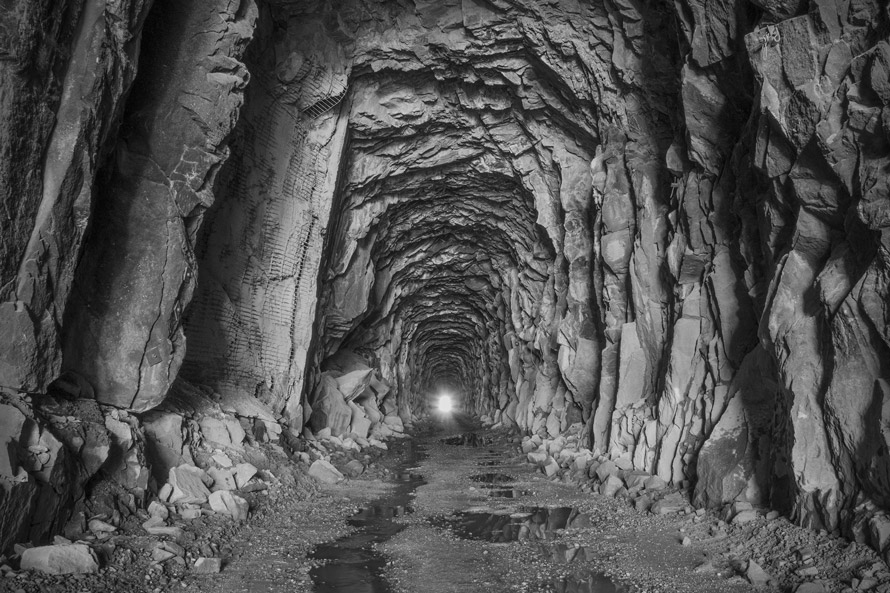
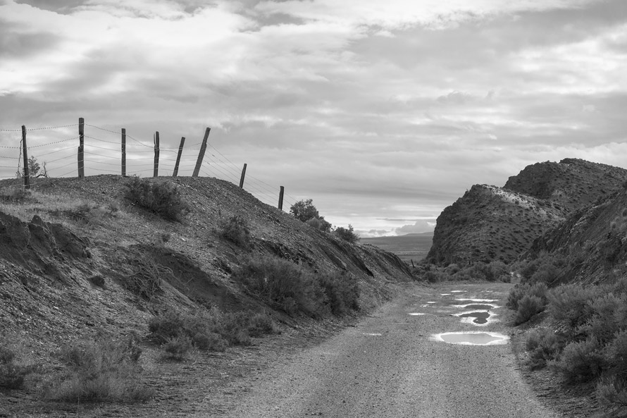
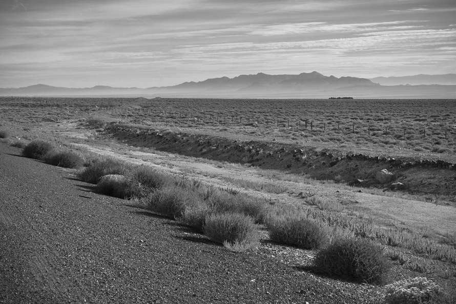
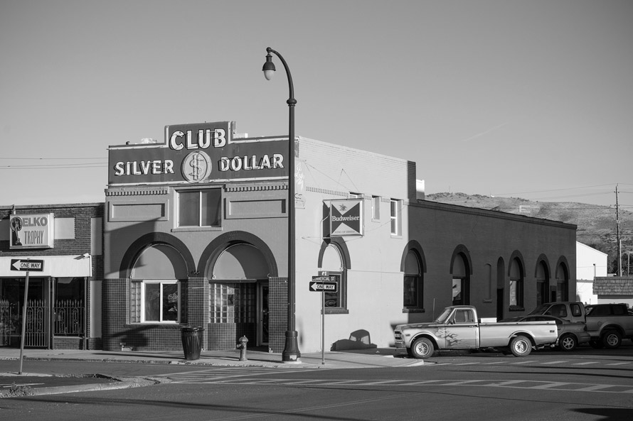
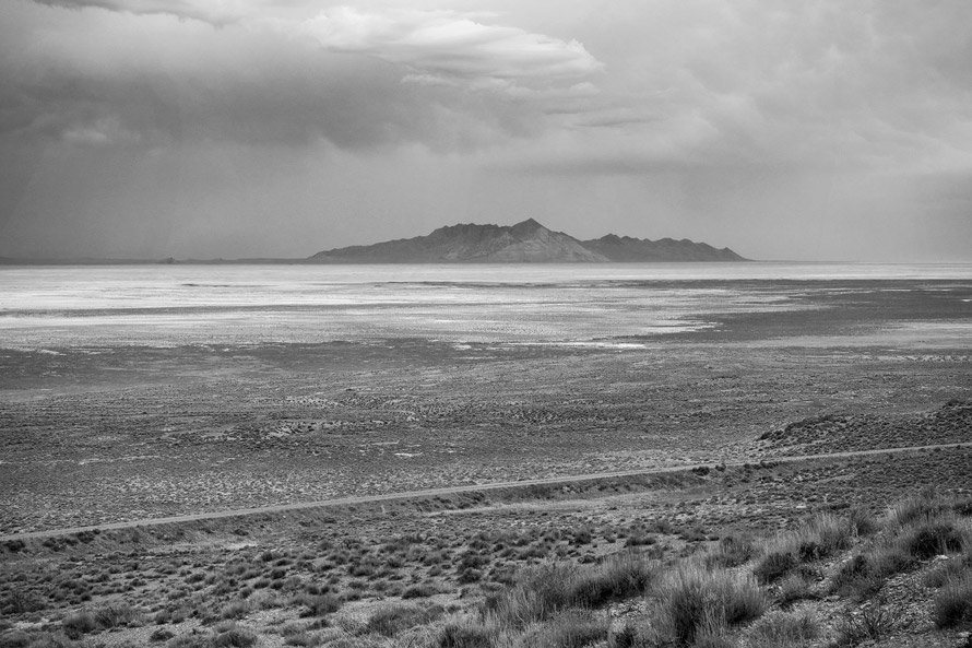
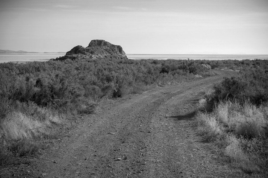
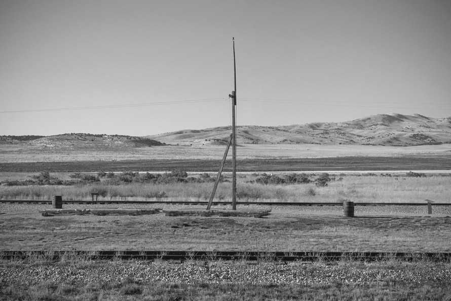
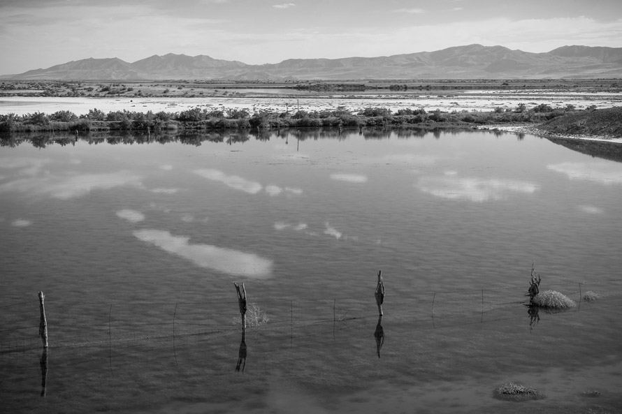
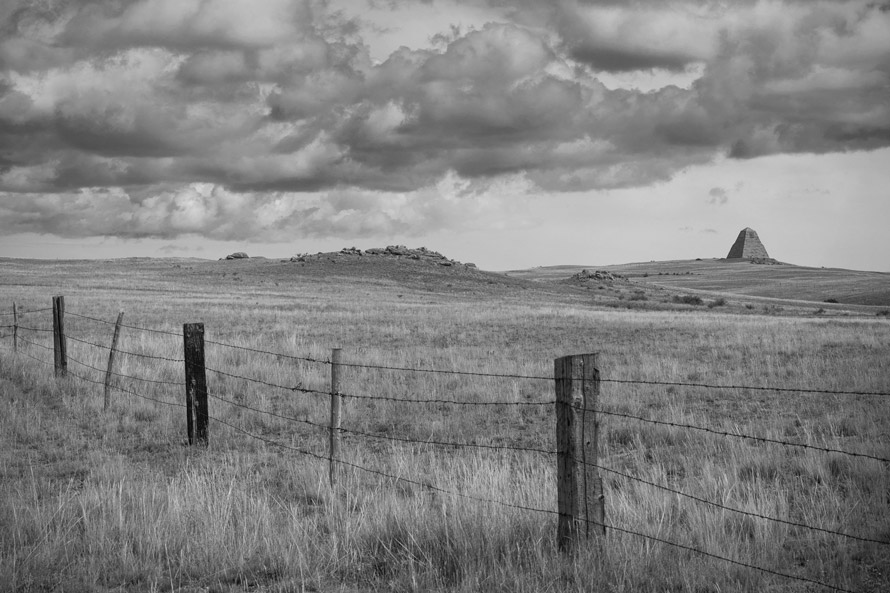
Tunnel Six, Donner Summit – Alternately called Summit Tunnel, this was the longest and most daunting of bores for the Central Pacific. With the tunnel being unlined, one can see drill marks more than a hundred and fifty years old. From here the line will drop rapidly into the Great Basin, passing Donner Lake and Truckee on its way towards Wadsworth, Nevada, and beyond.Former Roadbed, East of Midas Road, Near Golconda, Nevada – This image was made on a fairly long section of drivable former roadbed in central Nevada. These situations were created, mostly in the early part of the 20th century, when the original line was moved for a more favorable alignment.Abandoned Roadbed, Forty-Mile Desert – This is abandoned Central Pacific roadbed, as seen from the south edge of Interstate 80, in the Forty-Mile Desert. Remnants of the original grading, such as this, are of a human scale and readily call forth the workers of the 19th century.Elko, Nevada – The Central Pacific originally ran right through the center of Elko, in the vicinity of Railroad Street, not far from this spot. Please note the “E” on the hillside south of town—the creation of mountain monograms is a western tradition dating to the early part of the 20th century.Former Roadbed, Newfoundland Mountains in Distance – This view was made from a point just west of Red Dome Siding, along the former Central Pacific roadbed. Running for 94 miles within the state of Utah, between Lucin and Promontory Summit, this former roadbed is now a “Back Country Byway” maintained by the Bureau of Land Management.Lone Rock at Monument Point – A well-known landmark along the route of the Central Pacific, Lone Rock stands silent sentinel along the edge of the Great Salt Lake. As when I visit Robert Smithson’s Spiral Jetty, which is also located along the shore of this great body of water, I am nearly overcome with a profound sense of loneliness.
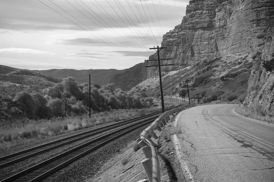
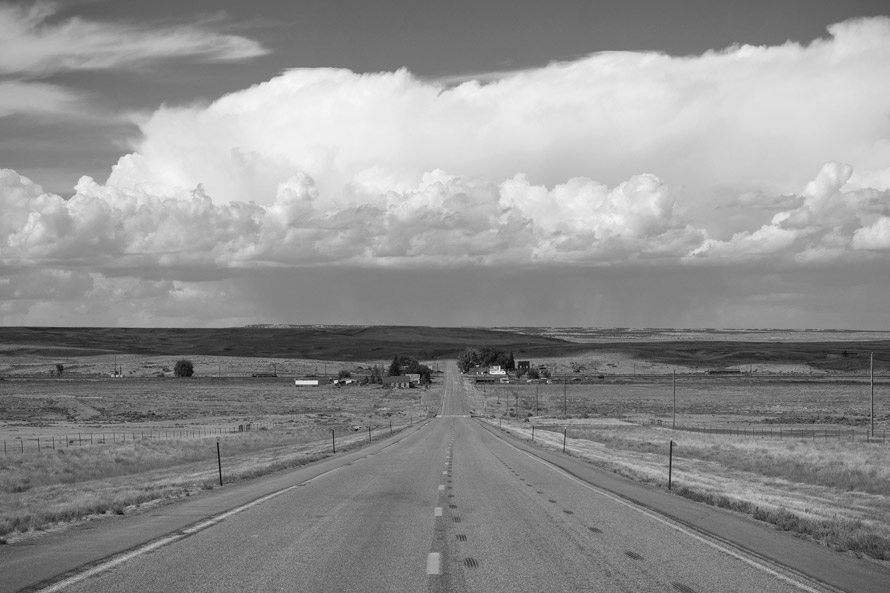
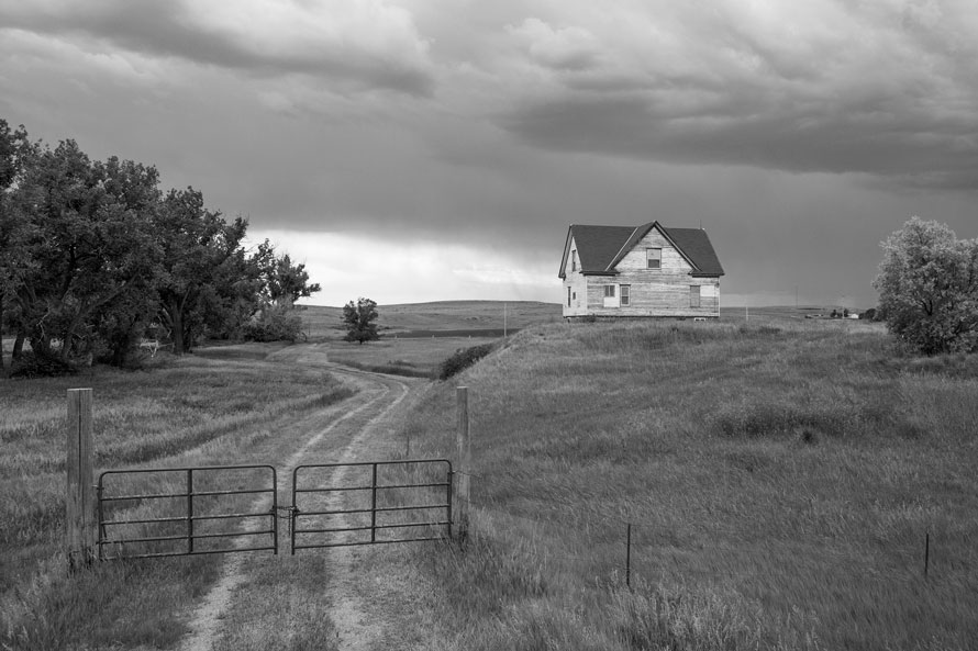
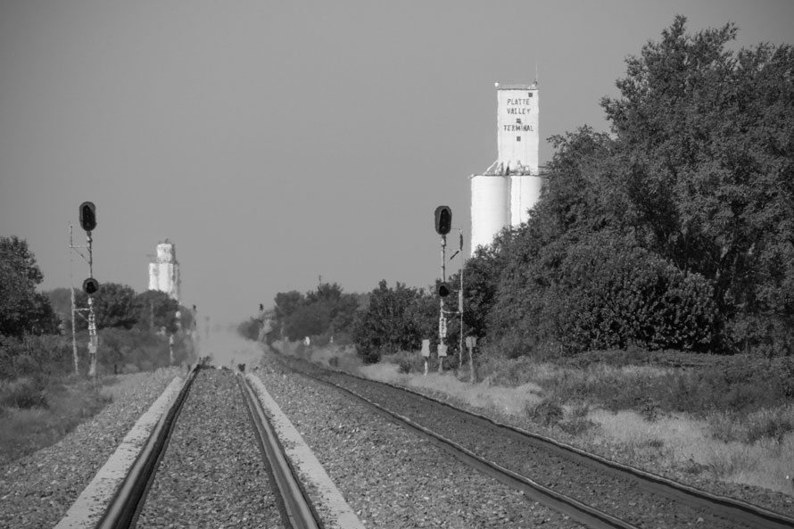
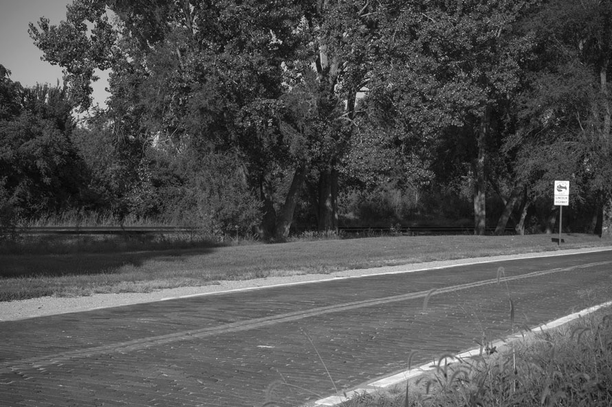
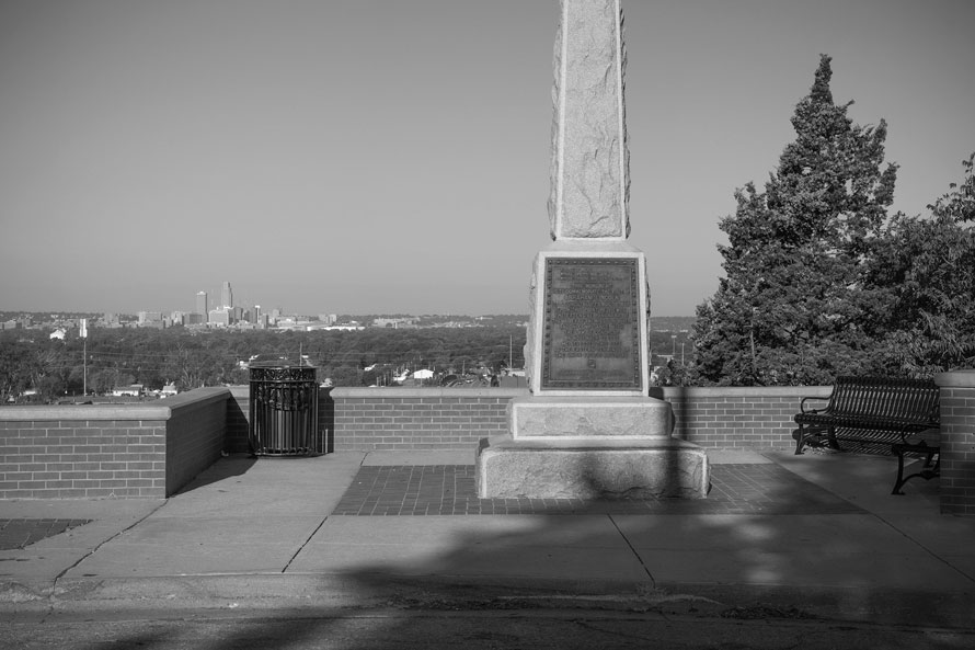
Golden Spike National Historic Site – The settlement lasted as an exchange point between the two railroads only for a brief time; it was shifted eastward to Ogden soon after the joining of the rails. In the oft-quoted words of Albert D. Richardson, Promontory Summit was “sans trees, sans water, sans comfort, sans everything.”Abandoned Roadbed West of Corinne, Utah – Just west of Corinne, Utah, abandoned roadbed of the Union Pacific can be seen running along the Bear River Migratory Bird Refuge, which adjoins the Great Salt Lake. In the background, the Promontory Mountains can be seen looming.Near Death’s Rock, Echo Canyon, Utah – Echo Canyon is among the most scenic of spots along the entire route of the Pacific Railroad. David Haward Bain, in his book The Old Iron Road, does a wonderful job relating the history of this unique and stunningly beautiful area.Carter, Wyoming – One has to travel north of Interstate 80 several miles to reach this spot, but it is well worth the time involved. Carter is a fine example of a small western town that has somehow survived semi-intact, with its trackside structures and classic example of a schoolhouse, now abandoned.Ames Monument, Old Sherman, Wyoming – This impressive monument, which stands sixty-five feet high, was built for a pair of brothers who were instrumental in getting the Union Pacific constructed. Oliver Ames served as the President of the Union Pacific Railroad. Oakes Ames was a Congressman from Massachusetts and a real prime mover of the endeavor. The town of Sherman was named for William Tecumseh, and is the highest point on the entire route between Omaha and Sacramento.Just East of Bushnell, Nebraska – This view was taken along the Union Pacific as it runs through the Nebraska Panhandle near Bushnell. Chief Engineer Grenville Dodge took the opportunity to name towns for political advantage, geographic features, as well as for vanity—Bushnell was board member of the railroad.Mirage: Silver Creek, Nebraska – This view was made looking down the Union Pacific main line at 36th Street, east of Silver Creek, in the eastern part of Nebraska. The “water” here is a mirage, but we are not far from the Platte River, which the line follows for hundred of miles just as pioneers did in the decades preceding it.Lincoln Highway, East of Elkhorn, Nebraska – The Lincoln Highway, which dates from 1913, follows the first transcontinental railroad in many places. It is not always a fine brick version such as we see here, however, but can be a simple gravel road, two paved lanes, or even certain segments of Interstate 80.Lincoln Monument, Council Bluffs, Iowa – Overlooking Omaha, this monument sits high above the flood plane of the Missouri River. Abraham Lincoln, prior to becoming President, visited this particular site in August of 1859. He later chose Council Bluffs as the eastern terminus for the Pacific Railroad, for which he was a huge proponent.
(Prior to this article in The Trackside Photographer, two articles of this work, Contemporary Views, have been published—in the journals of the Union Pacific Historical Society and the National Railway Historical Society.)
3 thoughts on “Contemporary Views Along the First Transcontinental Railroad”
Excellent article and great images.
Richard’s work was featured in a 40 page magazine of the NRHS Bulletin. Those interested in obtaining a copy can reach out to Editor Jeff Smith at bulletin@nrhs.com for details. Back issues cost $6 shipping included and payment can be by check or PayPal.
Are there any tour companies that traverse the Transcontinental Railroad through Nevada? It would be a fascinating trek. Gene Pokorny