The Kate Shelley Story

kate-shelley_web
Kate Shelley – Photo Courtesy of the Boone County Historical Society

Prologue

On a crisp July afternoon in 2012, I stood on the dried up banks of the Des Moines River near Boone, Iowa, watching a train fly overhead on the Union Pacific’s famed Kate Shelley High Bridge.  The train was traveling on a portion of the Overland Route, a highly trafficked rail route from Chicago to San Francisco.  The massive structure the train crossed stands nearly 190 feet above the river valley, and is a half-mile long.  While this certainly was a breathtaking scene for a 14-year-old bridge-hunter from Minnesota, it cannot compare to the story of the young woman for whom the bridge is named.  Upon starting Civil Engineering School at Iowa State University in August of 2016, I began to understand the true impact this legendary heroine had on generations of Iowa residents.

A Railroad Family

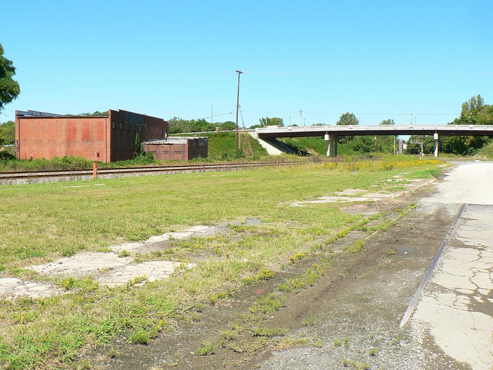
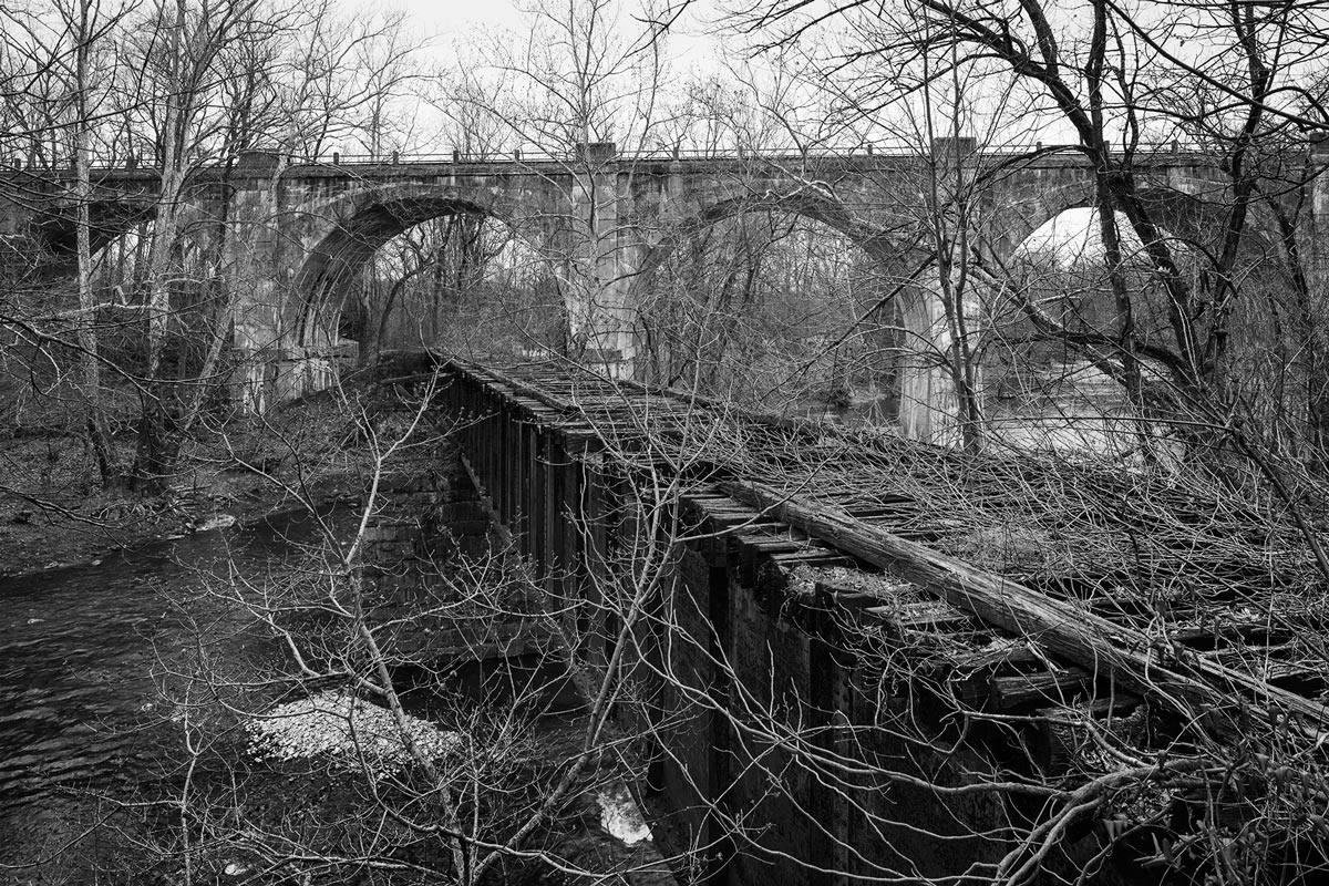
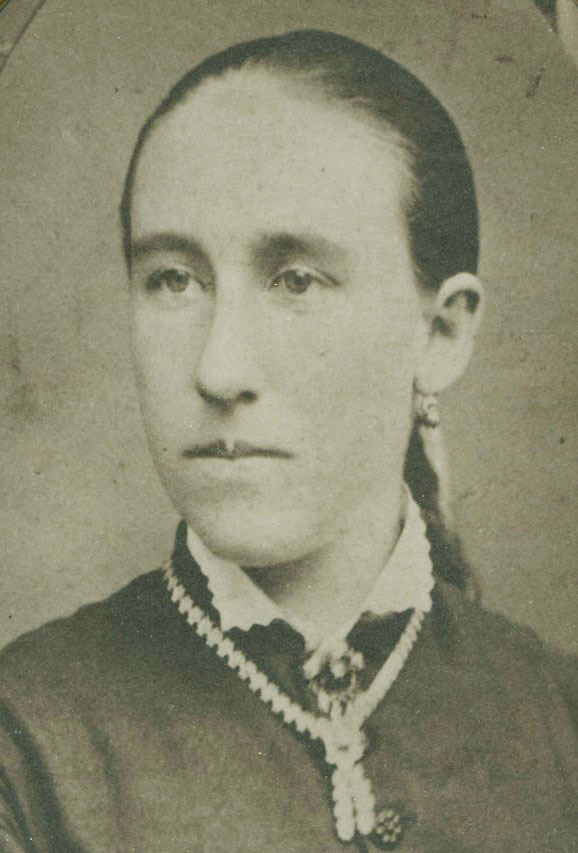
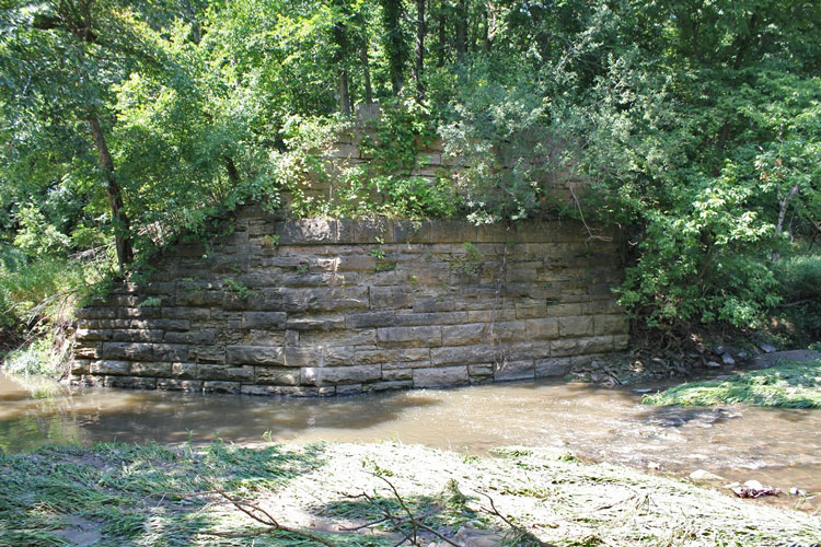
Katherine Carroll “Kate” Shelley was born in Ireland in December of 1863 to Michael and Margaret Shelley.  With four additional children the family immigrated to the United States when Kate was one year old.  At first, they lived near Freeport, Illinois,  but later moved to Boone County, Iowa.  The family settled on a large tract of land, which was unsuitable for farming, but the land was near the Chicago & North Western Railway mainline between Chicago and Council Bluffs, near Moingona. Michael took a job as a section foreman for the Chicago & North Western. Their land overlooked the Honey Creek Bridge.

When Kate was 12, sudden tragedy struck the family.  Her father was killed in a railroad accident shortly after her brother drowned.  Kate was suddenly thrust into control of the household, as her mother’s health declined.

The Beginning of a Legend

On the 6th of July in 1881, a particularly muggy and sunny day led to a series of heavy thunderstorms that came rolling out of the west in the evening.  Honey Creek was already running very high from previous storms, and the heavy rains of this night would increase the swell.  Kate and her mother kept a close eye on the stream, and at 11 PM heard a train with a four-man crew returning from Moingona to Boone.

kate-shelley-diagram_web
Diagram seen on the Moingona Depot – Photo Courtesy of the Boone County Historical Society

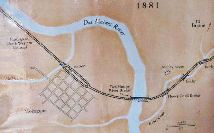
The next thing they knew, tragedy struck.  As Kate later recalled, there “…came the horrible crash and the fierce hissing of steam”.   As the train attempted to cross the Honey Creek Bridge, the wooden trestle gave way and sent the engine, and its four-man crew plunging into the creek.  Despite the initial shock of the accident, another thought came through the 17-year-old girl’s mind.  Another train, The Midnight Express, would be coming eastbound in about an hour, and Kate decided it was time to race into action.  Running to Honey Creek in an old dress and a tattered overcoat, she noticed two of the men clinging to branches.  Ed Wood and Adam Agar had escaped the tragic accident with their lives, clinging to trees to prevent that from changing.

moingona-bridge-1882_web
Moingona Bridge 1882 – The Des Moines River bridge she crawled over, Pictured Ca. 1882. Photo Courtesy of the Boone County Historical Society

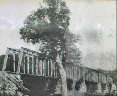
In the meantime, Kate knew she had to get to Moingona to stop the train.  She left the men in the perilous safety to prevent another tragedy.  The biggest obstacle was crossing the Des Moines River Bridge, a bridge that sat about 30 feet off the ground.  However, to discourage trespassing, the railroad removed some of the boards.  Kate would be in for quite a challenge as she crossed the bridge, literally on hands and knees.  With lightning and wind still fiercely surrounding her, she fought off splinters and ripped clothing to make it to Moingona, before collapsing.

When Kate regained consciousness a short time later, she was told that the stationmaster had recognized her as the daughter of Michael and suddenly realized the express must be stopped.  Kate insisted that a rescue party must be formed, and she returned with them to the Honey Creek Bridge.  Ed Wood was tossed a rope and helped to safety, while Adam Agar was rescued once the waters receded.  The other two crew members perished in the accident.

The news of the young heroine spread around Iowa, and eventually even made news internationally.  Reporters from all corners of the United States traveled to Iowa to interview her.  The ordeal, however, kept her bedridden for three months after the incident.

30906_web
Site of the original Honey Creek Bridge, which collapsed in July of 1881 under the weight of a train. New bridge was built Ca. 1900, and remains are of that. John Marvig Photo

A World Waiting

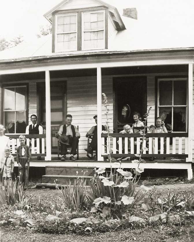
When Kate regained her strength later that fall, the whole world was waiting.  Passengers from the train she had saved pooled together a few hundred dollars for her. School children in Dubuque gave her a medal, and the State of Iowa contributed another.  The railroad gave her a lifetime pass, among other supplies.  A gold watch came from The Order of Railway Conductors.  In addition, she instantly became a sensation with poems and songs written about her.  Some were so impressed with her quick thinking, they raised enough money to send her to Simpson College in Indianola.  Even the college president was raising money for her to come, being so enamored by her bravery.  However, she came back home after one year, feeling that she belonged in Moingona.

As the years passed, her fame faded.  She became a schoolteacher in Worth Township, making $35 a month.  However, this money was not enough for ends to meet.  In 1890, it was discovered that her home was mortgaged, and she was in danger of losing it.  The public response for Shelley was nothing short of amazing.  The mortgage was paid off by auction of a rug in Chicago, and she was granted a large sum of money by the State of Iowa.  She was even written about for a grade school textbook.

Even in 2016, many children in Iowa learn about this figure from 135 years ago.  However, her fame was far from over; and her biggest rewards were yet to come…

This is Part One of  The Kate Shelley Story. Click here to read Part Two.

John MarvigPhotographs and text Copyright 2016
See more of John’s work at John Marvig’s Railroad Bridge Photography

Railroad Town:
 Concord, North Carolina

Lost

The Concord passenger station depicted in its full glory in this picture postcard circa 1920. The Cabarrus Cotton Mill is visible behind the structure. Image courtesy Concord Public Library

Firmly ensconced in the suburban sprawl of Concord, NC, lay a railroad past bypassed with explosive growth in the Charlotte metropolitan region. As time has marched onward, the expansion of Concord has cloaked a past not unlike numerous cities and towns throughout the North Carolina Piedmont. Whereas the dependence on the railroad, whether it be for passenger travel or the corridor for a bygone textile industry, is gone, the stamp of the past remains conspicuous along this former Southern Railway main line. Modern day annals, however, tend to overlook Concord as compared to other locations along the route such as Salisbury, Spencer, and Kannapolis. Archival photographs of the railroad in Concord are few in number which has continued to trend as there are few contemporary photos taken here as compared to other locations.

This 1921 Sanborn Fire Insurance map focuses on the central area of this treatise. Depicted in this map are the Concord station, Cabarrus Cotton Mill, and the Southern Railway freight station as each was laid out.

The railroad origins of Concord date to the antebellum period a decade before the onset of the Civil War. In 1848, the North Carolina Legislature passed a bill for the construction of a railroad connecting the coastal region of the state with the interior Piedmont. The following year, the North Carolina Railroad (NCRR) was chartered with the intent of constructing a 223 mile corridor between Goldsboro and Charlotte. On July 11, 1852, a groundbreaking ceremony was held in Greensboro and construction of the railroad began. Four years later, towns along the route, including Concord, witnessed the passage of the first train to traverse the length of the railroad in January 1856.

After the tumultuous Civil War years, the Richmond & Danville Railroad (R&D) signed an operational lease with the NCRR in 1871. This lease remained in effect until the R&D was acquired by the Southern Railway in 1894. Maps of Concord during this era are in existence and indicate the exact location of the first depot. However, there appears to be no photographs or artist renditions in the public domain to reveal the early appearance of this structure.

During the early 1890s, the Concord Railroad Company constructed a line from the depot area into the downtown district to serve the local businesses. Due to the topographical layout of Concord, the town is located on the heights above the railroad and the public sought improved efficiency for transport. Rather than walk or traverse these grades by horse and wagon, an inner city line was constructed to alleviate these concerns. Designed as a “steam” line and dubbed the “Dummy Line”, this street track diverged from the Richmond and Danville main line and ran on Corban Avenue until reaching the business district at Union Street. Here, it turned west and split numerous times with spurs to serve the local proprietors. Within a few years, it was extended further north on Union Street and to the Gibson Mills plant at present day McGill Avenue. In spite of these efforts, the “Dummy Line” was plagued with problems, most notably pertaining to reliability issues. Concord was among the first urban areas in the United States to utilize battery powered street cars and their usage on this route was generally unsuccessful. The battery life was short and passengers frequently assisted by pushing these cars. By the end of the century, the “Dummy Line” was history and Concord constructed a true streetcar system which partially utilized this former route.

An 1892 Sanborn map highlighting old downtown Concord which reveals the route of the “Dummy Line”. Route connected the Southern Railway station with the business district on Union Street.
An 1892 Sanborn map highlighting old downtown Concord reveals the route of the “Dummy Line” which connected the Southern Railway station with the business district on Union Street.

By 1892, a Sanborn Fire Insurance map indicates that a small wooden passenger station existed on the west side of the now Southern Railway main line opposite the freight depot and cotton platform on the east side. A separate smaller structure was located adjacent to it. Perhaps this was also the location for the original station as well—structurally repaired as needed but oddly located opposite the town district side of the railroad. It was also during this era that the Cabarrus Cotton Mills was constructed opposite the station on the same side of the tracks as the freight depot.

At the turn of the century, a new passenger station was constructed on the east side of the railroad by the Corban Avenue grade crossing south of the freight depot. This structure was also of wood construction and included a separate baggage office. The life span of this station was through the first decade of the 1900s until 1913. It was that year that a new passenger station would be constructed serving Concord until the 1970s.

A view of the less seen south end of the passenger station as it appeared during the 1960s. The bridge in the distance is Cabarrus Avenue and the freight depot---now gone-- was on the immediate opposite side. Image Concord Public Library/Independent Tribune
A view of the less seen south end of the passenger station as it appeared during the 1960s. The bridge in the distance is Cabarrus Avenue and the freight depot, now gone, was on the immediate opposite side. Image Concord Public Library/Independent Tribune

Construction began on the larger station several hundred feet south of the existing depot. The location, in effect, sandwiched the new site between the Southern Railway main line and the Cabarrus Cotton Mills. This new station, built with brick and trimmed in wood, was resplendent in the Victorian influence of the era. Solid and attractively designed, it became the railroad centerpiece for Concord during the halcyon years before the end of passenger service. The World War II years in Concord, as in countless other stations throughout the nation, proved a bright but brief zenith of the passenger train in full glory. As an example, in 1941, fourteen trains still called at Concord. Name trains such as the Piedmont Limited #33 and #34, the Peach Queen #29 and #30, and regionals such as #11 and #12, the Danville, VA – Greenville, SC, all stopped at Concord.

Before: Looking south from the Cabarrus Avenue bridge area at the passenger station and the Cabarrus Cotton Mills building as it was in January 1974. By this date, the station was a silent symbol of a bygone era. Image Concord Public Library/Independent Tribune
After: Four decades later, a similar view of the station area. Amtrak #76 passes in ironic vigil where whence passenger trains stopped. Image Dan Robie 2016
After: Four decades later, a similar view of the station area. Amtrak #76 passes in ironic vigil where once passenger trains stopped. Image Dan Robie – 2016

In the postwar years, as passengers left the rails in mass exodus, trains were either combined or abolished. Examples affecting the patronage at Concord included combining service from two trains into Southern’s flagship Crescent Limited. The southbound Aiken-Augusta Special was absorbed into the Crescent in 1956 and the northbound Peach Queen several years later in 1964. Further cutbacks would ensue as the passenger base eroded and services were discontinued. In 1971, what remained of the national passenger network was forged into Amtrak but the Southern Railway remained a stalwart by continuing to provide its own service that would continue through the 1970s.

 In March 1974, a northbound Southern Railway manifest derailed in proximity to the passenger station. As evidenced in this image, cars were scattered and the structure received damage to its front. Image William Teal/Independent Tribune.
In March 1974, a northbound Southern Railway manifest derailed in proximity to the passenger station. As evidenced in this image, cars were scattered and the structure received damage to its front. Image William Teal/Independent Tribune.

In March of 1974, northbound manifest train 158 was passing through Concord when a defective wheel on a freight car picked a switch causing a derailment. This resulted in a pile up at the station area and the building sustained damage to its south and west sides. The damage was repaired but by this date, the venerable old structure was nearing the end of its useful life. In 1976, came the coup de grace. Trains #1, the southbound Southern Crescent, and #5 and #6, the Piedmont, remained on the timetable but by the end of the year, the Piedmont was abolished. With the discontinuance of the Piedmont, Concord was eliminated as a passenger stop. The Southern Crescent existed for another three years until the Southern Railway turned over its passenger operations to Amtrak.

After 65 years of existence, the noble Concord passenger station faces its end. The date is March 28, 1978 and the structure will soon vanish beneath the bulldozer’s tread. Image Concord Public Library/Independent Tribune
38 years after its demolition, remnants of the rear platform still exist. Rails of a spur that ran behind the structure remain in place. Image Dan Robie 2016
Thirty-eight years after its demolition, remnants of the rear platform still exist. Rails of a spur that ran behind the structure remain in place. Image Dan Robie – 2016

On March 28, 1978, an epoch ended. The noble Concord passenger station, standing in silent vigil to a bygone era, met its end. Demolition began on this date and as the bricks crumbled, the visible connection to passenger rail at Concord belonged to history. It is, in a sense ironic, as a regional passenger rail renaissance occurred the following decade. In 1984, a joint effort by the North Carolina Department of Transportation (NCDOT)and AMTRAK resurrected the Piedmont train although it lasted but a year due to agreement conflicts. After a five year hiatus, service was resumed in 1990 and subsequently expanded in the 21st century. Today, eight passenger trains—the Crescent Limited and six Piedmonts— pass through Concord by the empty lot where its station once stood. With no structure to serve as a stop, Concord is now but a milepost location along the main line, nestled between the stops at Kannapolis and Charlotte. Whether a new station is constructed to restore Concord as a terminal may be a topic of future city discussion.”

Many an engineer looked at this cantilever signal as northbound trains departed Concord. It, too, will pass into history as evidenced by its replacement under construction. Dan Robie 2016
Many an engineer looked at this cantilever signal as northbound trains departed Concord. It, too, will pass into history as evidenced by its replacement under construction. Dan Robie – 2016

Dan RobiePhotographs and text Copyright 2016
See more of Dan’s work at his website WVNC Rails.

Editor’s Notebook

img013
Buchanan, Virginia – Johnson Family Residence – circa 1936

Place in Photography

“Place conspires with the artist. We are surrounded by our own story, we live and move in it. It is through place that we put out roots.” - Eudora Welty

This photo was taken by a member of my family around 1936. That is my grandfather in the middle with his hat on his knee. My mother is the blond-headed girl on the left, half in and half out of the frame. It would be another ten years before she would marry and I would come along.

Unlike so many family photographs that fill the frame with a person, this picture reveals the spirit of a place, and that is what makes this old photo special to me. The people in the photo are in context. Their life and the place where they lived it are visible. I knew this place. I remember sleeping in the attic room behind the dormer windows above the porch, and the rain on the tin roof.

The best photographs come when the photographer makes a connection to a place and responds to it. For us railroad photographers, that may mean backing up a bit to see the broader context, or going deeper to uncover the history and meaning of a place.

This came to mind recently while reading about two multiple-year photography projects.

Michael Froio wrote about his Pennsylvania Railroad project, From the Mainline, in an article which we published (here) on The Trackside Photographer last week . He writes:“My goal when I set out was to satisfy a curiosity, but what I think I have done is expand my use of photography to become part of a larger idea interpreting the social, industrial and railroad history in a creative and accessible way.”

And in the latest issue of Railroad Heritage, the quarterly journal of the Center for Railroad Photography and Art, Marc A Entze writes about his experience photographing an small Idaho short line over the course of a decade. In “To Fully Photograph a Place” (pp18-39) he tells how his experience with the railroad deepened over the years as his photography went beyond beautiful railroad scenery to find the soul of the place and the people who lived and worked there. The railroad is now gone.

My grandparents died in 1963 and their house was sold. A few years later, it burned down. Their place survives in a single photograph. I wish there were more.

 Edd Fuller, Editor
Your thoughts and comments are welcome

From the Main Line

froio_tsp_034
View of the Main Line, East Conemaugh, Pa. This image highlights the long-standing relationships of industry and the railroad. In the case of the Johnstown area, it was steel and the Pennsylvania Railroad.

The Project

This project’s title, From the Main Line, came to me since I began traveling throughout the Northeast exploring what survives and what developed as a result of the presence of the Pennsylvania Railroad.

The project is the culmination of four distinct interests and their interaction: geography, history, architecture, and a life-long love of railroads. Among other reasons, I chose the Pennsylvania Railroad to satisfy a simple question; “Why would a company consider itself the Standard Railroad of the World?” I am sure many would argue that it was just plain arrogance, but that answer was not good enough. Starting in 2007 I set out to better understand the former PRR system by examining the various aspects of the railroad to create a cohesive survey of the railroad, its defining attributes and the landscape through which it traveled.

There are several concise topics that combine to create a holistic understanding of a railroad network and its effects on its surroundings. This approach can help one to identify the unique characteristics of any railroad corridor but specifically those that refer to the Pennsy.

froio_tsp_006
30th Street Penn Station and Powelton Avenue coach yard, Philadelphia, Pa. The PRR had a rich history in the city of Philadelphia. The PRR’s corporate headquarters, undertaking one of the largest public-private urban renewal projects, greatly re-shaped the landscape of Center City and West Philadelphia.
My approach

Unlike the railroads born of the United States’ westward expansion, the Pennsy was built and prospered in the established northeastern region. Much of the original route from Harrisburg to Pittsburgh followed a private rail line that was part of the Main Line of Public Works (MLPW), a combination canal and rail system that ultimately failed. In 1854 the PRR bought the MLPW, and later the canals were filled in. Forges, mines, and transportation centers had formed around the canals, but flourished after the arrival of the railroad. Highlighting this history of the neighboring landscape was important to establish the visual identity of a very distinct topography.
Over this topography, the railroad traveled through a landscape both remote and civilized, but the physical plant itself is a unique engineered landscape, often identifiable by vernacular attributes specific to the railroad that constructed it.

overbrook
Overbrook Station, Philadelphia, Pa. One of the oldest functioning stations on the Pennsy’s main line, Overbrook marks the beginning of where the hallowed Paoli Local serves the string of suburbs known locally as the ‘Main Line.’ The railroads played a formative role developing these areas in an effort to channel businessmen from work in the big city to a life in the quiet countryside.

The right-of-way is perhaps the most recognizable attribute of the railroad. The Pennsylvania Railroad was a two-to-six-track wide main line that cut across the land on a highly engineered corridor largely separated from the outside world. A result of years of refinement, this infrastructure allowed the PRR to move countless trains using traffic management systems that enabled fluid operation of both freight and passenger traffic within shared track space. Linking towns, cities and industry, the right-of-way of the Pennsylvania Railroad is immediately recognizable and stands out among its peers due to its sheer magnitude. East of Harrisburg, the towering poles and tethers of wires for the electric traction system further define the right of way and has distinction as the only surviving long-distance electrified mainline in the United States.

The right-of-way supported transportation networks vital to the public and industry. An extensive passenger network moved people on long distance, regional, and commuter trains from stations that ranged from monumental metropolitan gateways to a simple frame structure. It was also the supply chain for industry, connecting line side mining, manufacturing, steel production, and deep-water ports. Most of the freight was moved on the Low Grade, a freight bypass built between the Delaware and Susquehanna rivers. This route was a testament to the PRR’s engineering prowess and a final piece of the railroad’s massive system-wide improvements at the turn of the 20th Century that would make the railroad worthy of the title, Standard Railroad of the World.

dock_4
Dock Interlocking, Newark, New Jersey. This expansive interlocking was a shining example of the PRR’s use of fly-over trackage to manage the east end of a congested station area and the crossing of the Passaic River on three movable bridges servicing both the PRR and Hudson & Manhattan train operations.

The railroad corridor is an assemblage of engineering feats used to manage high volumes of traffic, setting it apart from other railroads of the era. Ranging from bridge construction, the massive flying junction, the interlocking technologies that controlled them and the electrified rail network east of Harrisburg,  the PRR spared no expense to improve efficiency and capacity. Fortunately, surviving elements provide insight on how the railroad functioned, including the many stationary and movable bridges, terminals, and extensive interlockings throughout the system.

Perhaps one of the most challenging aspects of documenting a railroad that has been gone for more than 45 years is envisioning what was lost in order to understand how the original network worked. Whether a result of recent or ancient railroad history, it is the archeological aspect of this project that requires the most imagination to complete the puzzle that was the Main Line network. There was considerable abandonment and change after the fallout of Penn Central and the creation of Conrail and Amtrak which forever changed the railroad landscape and operations. As a result, defining attributes like the Low Grade and many of the interlocking towers and stations were abandoned, eliminating evidence of the larger unified system.

froio_tsp_015
Former Columbia & Port Deposit Branch crossing the Octoraro Creek and abandoned branch line, Conowingo, Maryland. The loss of the Octoraro branch is one example of how abandonments present a challenge in envisioning the expansive operations of the former Pennsylvania Railroad.

Research is the element that ties everything together: the stories, history, triumphs and failures behind the surviving objects and places. Utilizing historical photographs and maps adds a layer of context to the contemporary images, something that was absent in my earlier work. Understanding the historical significance gives me a better perspective of a place before I visit and allows me to create more informed images. Putting together my findings, and sharing information fuels the creative process. This element in the Main Line project allows me to expand the reach of my audience beyond the rail community, connecting with the casual observer, historian, architect, and engineer alike.

A Conclusion

My goal when I set out was to satisfy a curiosity, but what I think I have done is expand my use of photography to become part of a larger idea interpreting the social, industrial and railroad history in a creative and accessible way. As this project continues I start to ask the question, was the PRR the Standard or the exception in the railroad world, doing things differently literally from the ground up?  When will it be done? I don’t really know. I just know railroads have been a life long interest, and it’s nice to combine it with my creative work. I hope that my approach to railroad photography will inspire others to explore and understand their favorite railroad differently the next time they are out on the main or even a branch line operation.

The Trackside Photographer is pleased to present a gallery displaying 40 images from Michael's project. Click here to view the gallery, or go to the Galleries menu at the top of the page.

Michael FroioPhotographs and text Copyright 2016
See more Michael’s work and his blog Photographs & History at www.michaelfroio.com

Maine Central Remembered

January, 1968
bar-nome-jct-1226
“Tower MD’s building housed the CTC machine, relays and electronic equipment, a robust heating system, the operator, and a cat.”

When passenger service on the Maine Central Railroad (MEC) ended in 1960, I was 15 years old and had never been to the State of Maine. After the passenger trains were gone, the freight business was alive and well, thanks to the smart investments and wise business management of E. Spencer Miller, President of the railroad from 1952 through 1975.

My introduction to Maine was in 1964 through Colby College, which together with the railroad, was a major presence in Waterville, where the Maine Central had its repair shops, and its largest and most important classification yard.

Excursions beyond Waterville served as a diversion and study break from grinding through textbooks in the college library, and presented the chance to learn more about the railroad and how it worked.

One bitterly cold January day, a trip to explore the eastern portions of the Maine Central seemed like a good idea. I headed up toward Northern Maine Junction, where the MEC interchanged cars of Maine products, including printing paper, pulpwood, and potatoes, with the Bangor and Aroostook Railroad.

Around 1957, the Maine Central was still very much investing in the railroad, and a new CTC installation between Pittsfield and Northern Maine Junction was authorized to realize savings in redundant trackage and improve efficiency in the operation. The upgrade eliminated double track, and replaced the automatic block signals with a modern centralized traffic control system.

Tower MD’s building housed the CTC machine, relays and electronic equipment, a robust heating system, the operator, and a cat. On this winter day, I’m sure Phil Butler, the tower operator,  was not expecting any weekend visitors to his lonely outpost, but he was most cordial and welcoming. I think he appreciated anyone who was interested in what he did and how he did it. After some railroad small talk, he explained the machine and how it worked. Tower MD was also a train order office, and so the order hoops and train order signal over the building were part of the station’s equipment.

To me, these photos are a time capsule of the Maine Central in good times. Trains were run at speed on well maintained track, most of the time with “High Green” Clear signals displayed.

After the boom years of the 1970’s, a combination of business and economic factors brought the Maine Central to its knees. Wall Street raiders took over the debt free railroad, precipitating a long and bitter strike of the Maine Central’s loyal and hardworking employees.  Hundreds of track miles which had served the state’s industries for one hundred years and more were either abandoned or no longer maintained.

Today the CTC is gone. Most of track has a speed limit of 10mph, and many of the paper mills have closed as their product has become unneeded in the internet world.

It has been hard to watch the decline, but I certainly have many wonderful memories of what main line railroading was like Down East, back on that bitter cold winter afternoon.

bar-nome-jct-1225
Tower MD – Northern Maine Junction

Bob Hughes – Photographs and text Copyright 2016