Railways of Greece
 Part 1

P4271862_RR_Sta_Korinthos__110427_resize_web
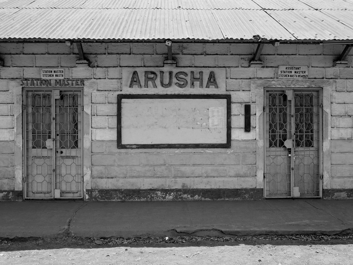
The Athens to Peloponnese Railroad Station
Corinth, Greece

The Piraeus, Athens and Peloponnese Railways or SPAP (in Greek: Σιδηρόδρομοι Πειραιώς-Αθηνών-Πελοποννήσου or Σ.Π.Α.Π.) was founded in 1882 to connect the port of Piraeus (Πειραιεύς) with Athens and the Peloponnese region of southern Greece. The late-1800s was the era of great railroad building throughout the world. Greece, at that time a poor nation with isolated market towns and limited roads, hoped to support economic development by building a rail system. The Peloponnese line reached Corinth in 1885 and Patras in 1887. SPAP was absorbed by the Hellenic State Railways in 1962, now called OSE (Greek: Οργανισμός Σιδηροδρόμων Ελλάδος or Ο.Σ.Ε.). The Peloponnese rail was 1,000 mm (3 ft 3 ⅜ in.) narrow-gauge, in contrast to the continental-standard 1,435 mm (4 ft 8 ½ in.) used in most of mainland Greece. The line from Piraeus to Corinth was 99 km long. In the 1890s, it was the fastest way to make the journey, the alternate being a steamship trip.

Corinth-map

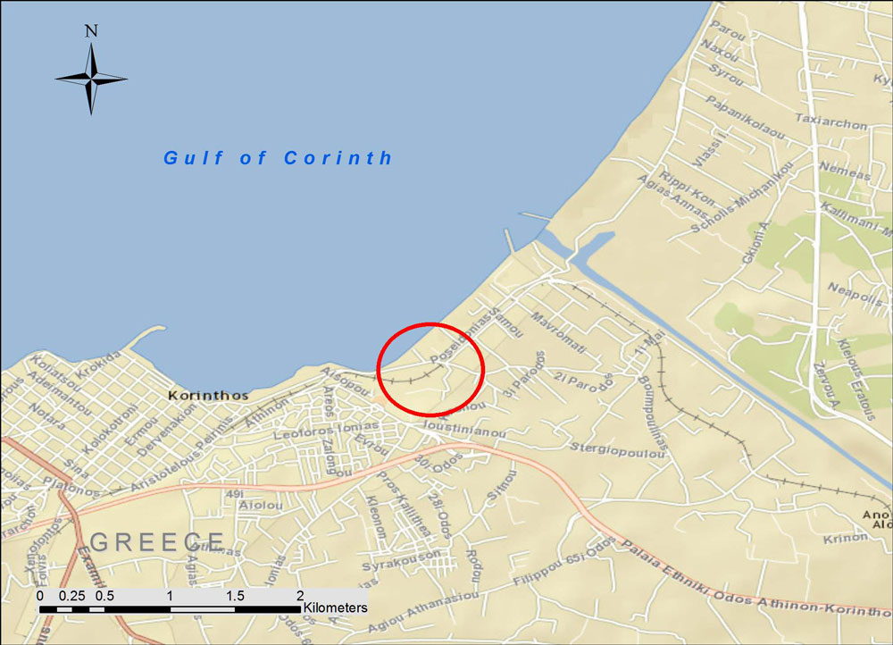
The map shows the location (background street map from ESRI maps and data). During the mid-20th century, tourists arriving from Italy typically took a ferry boat from one of the Italian Adriatic ports to the city of Patras, where they disembarked. Then the SPAP train took them on a leisurely day-long ride to the old central rail station in Athens. Once the modern highway was built in the 1960s, many travelers took diesel buses instead. As a result, they rushed past the charming little market towns clustered along the shore of the Gulf of Corinth and missed the train experience.

P4271858_RR_Sta_Korinthos__110427_resize_web

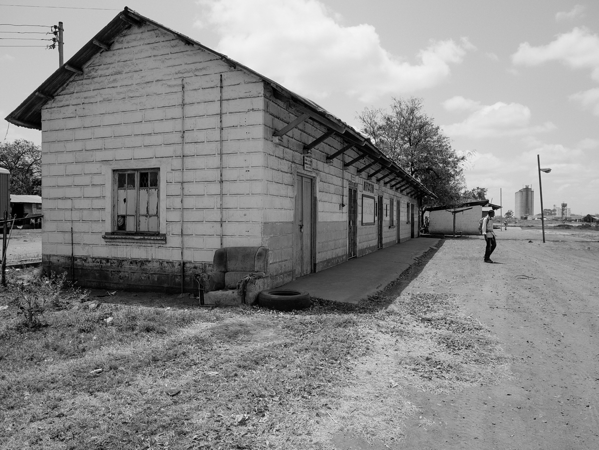
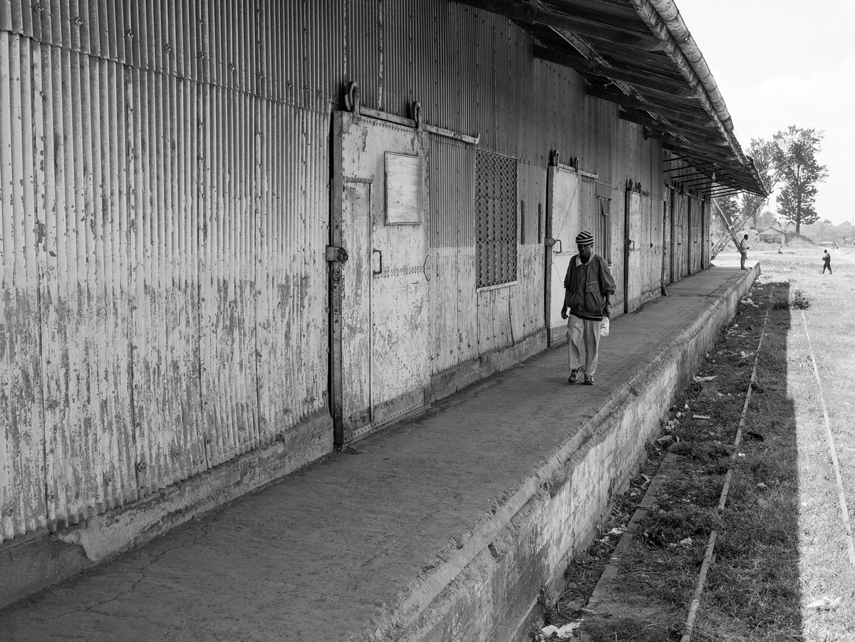
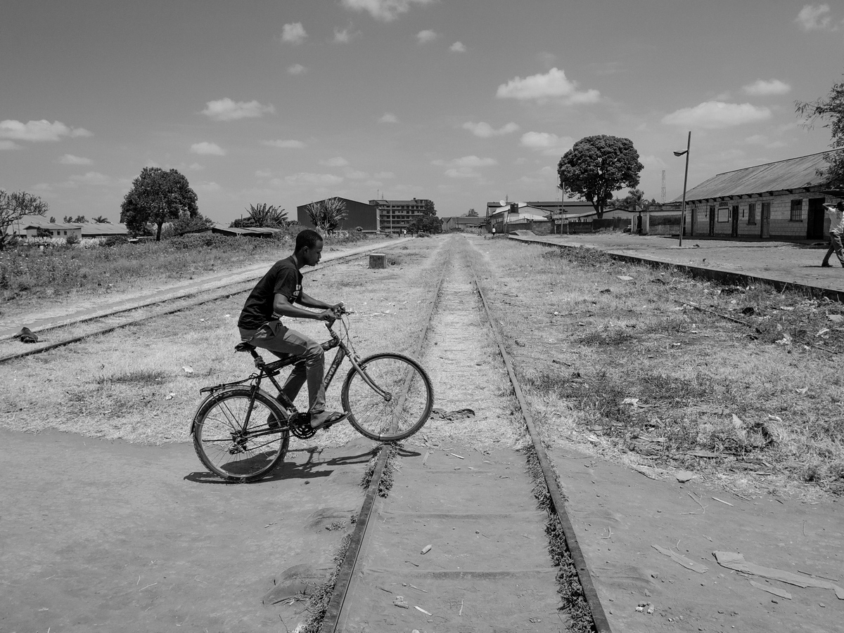
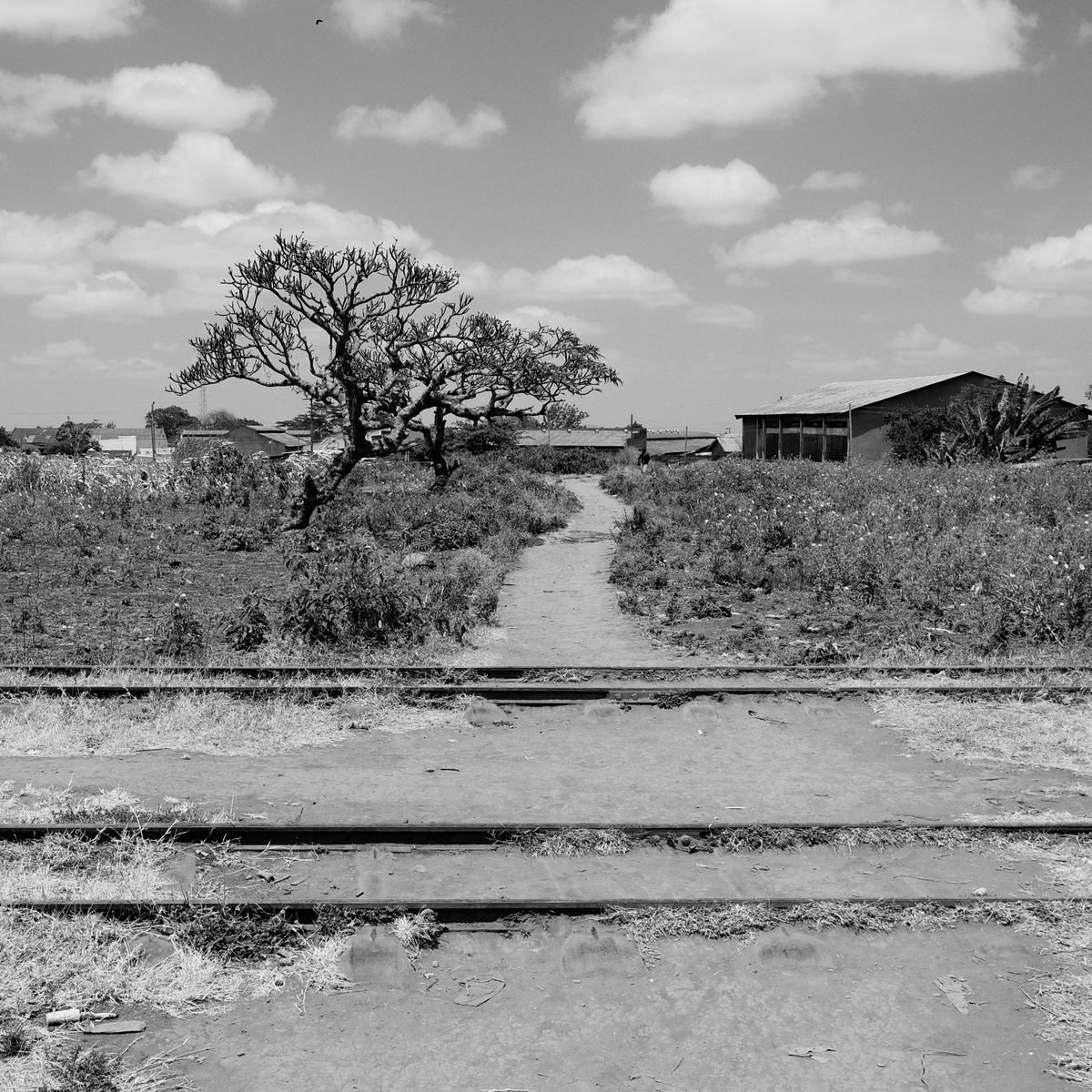
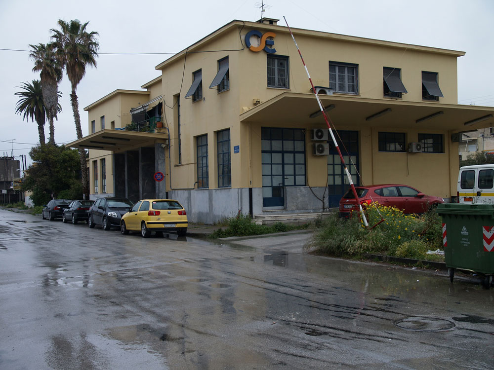
Today, the rail station in Corinth on Dimokratias Street stands semi-abandoned. As of 2005, the modern suburban rail connects the Athens Elefthérios Venizélos (Ελευθέριος Βενιζέλος) International Airport with Corinth and, now continues further west to the town of Kiato. Eventually, the modern rail will extend all the way to Patras, and the rest of the historic narrow gauge train will be discontinued.

P4271856_RR_Sta_Korinthos__110427_resize_web

P4271860_RR_Sta_Korinthos__110427_resize

P4271857_RR_Sta_Korinthos__110427_resize

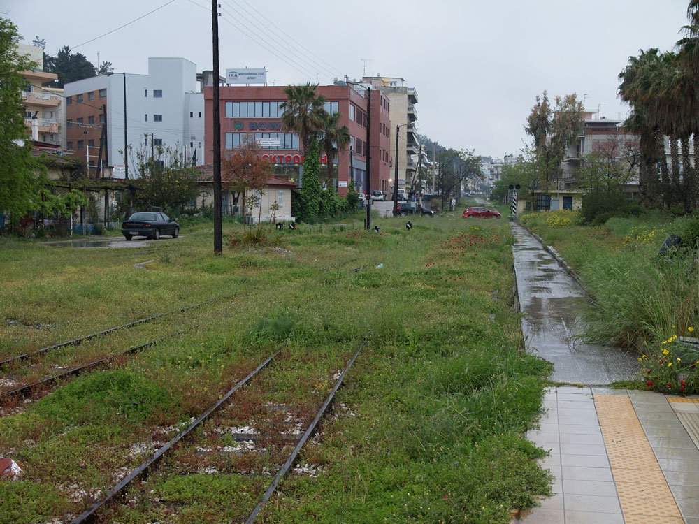
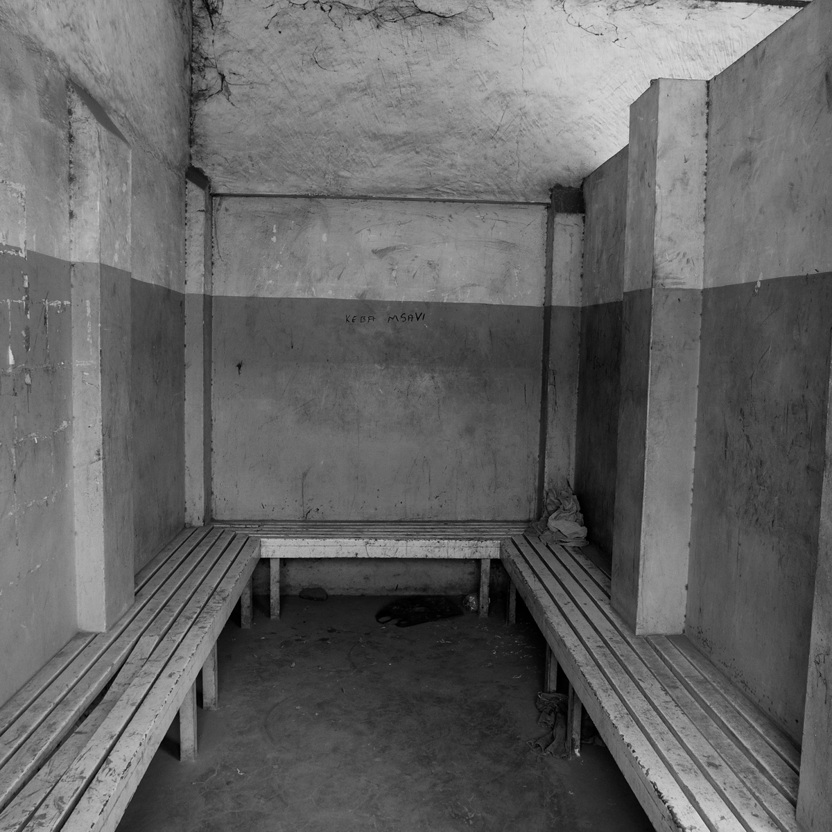
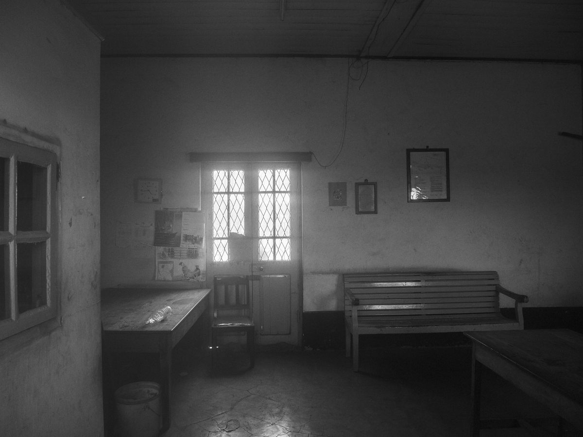
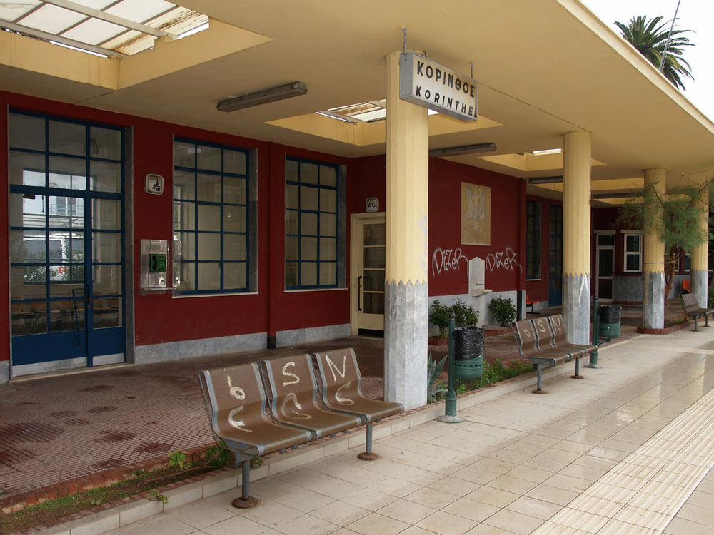
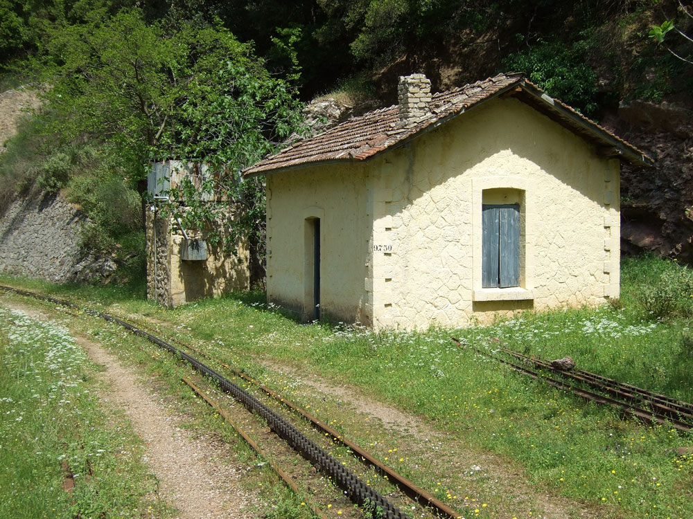
This station looks like it is late-1940s or 1950s-vintage. Corinth was badly damaged by an earthquake in 1928, and possibly that eventually necessitated a new station. Another hypothesis: The railroad suffered extensive damage during the second World War, and maybe the original station was damaged.

P4271855_RR_Sta_Korinthos__110427_resize_web

P4271859_RR_Sta_Korinthos__110427_resize_web

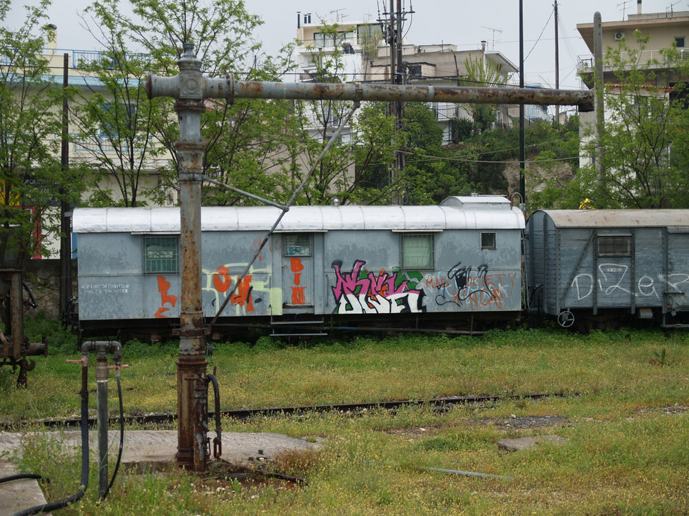
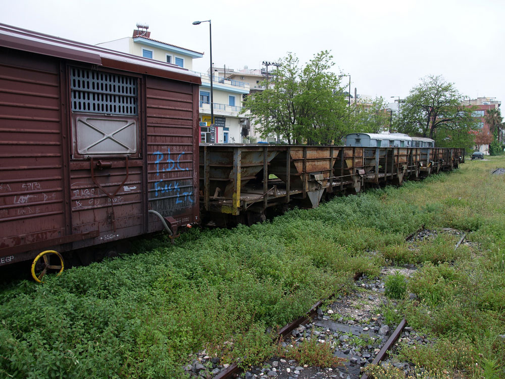
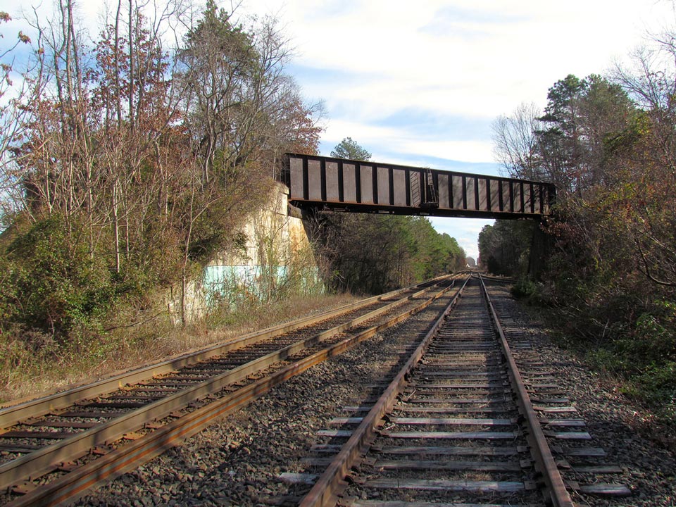
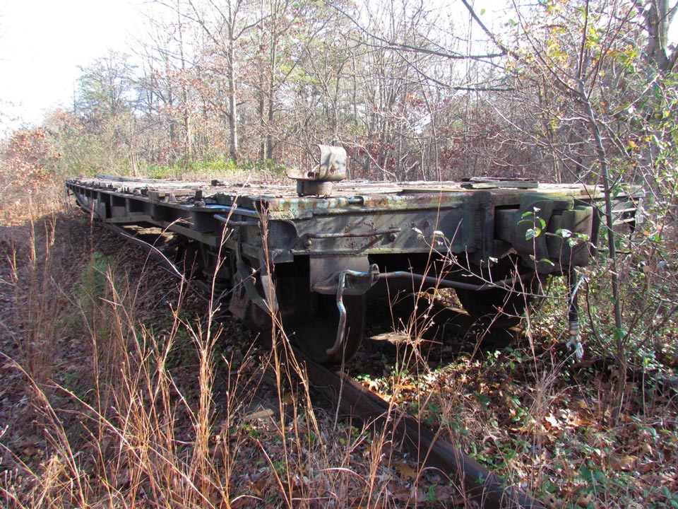
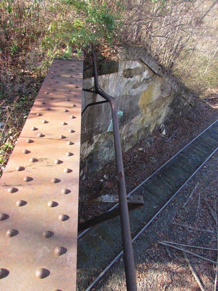
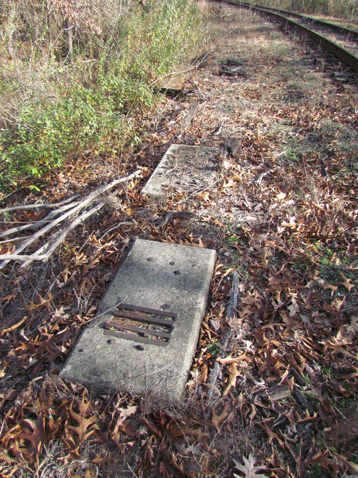
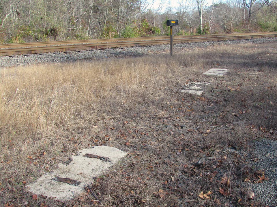
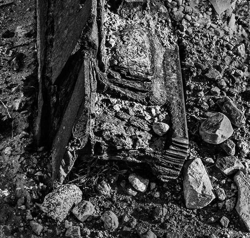
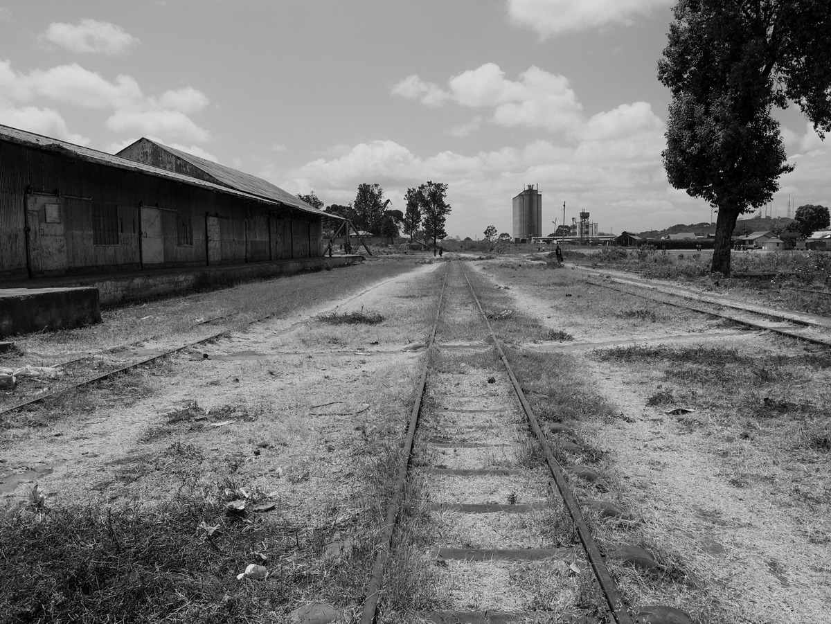
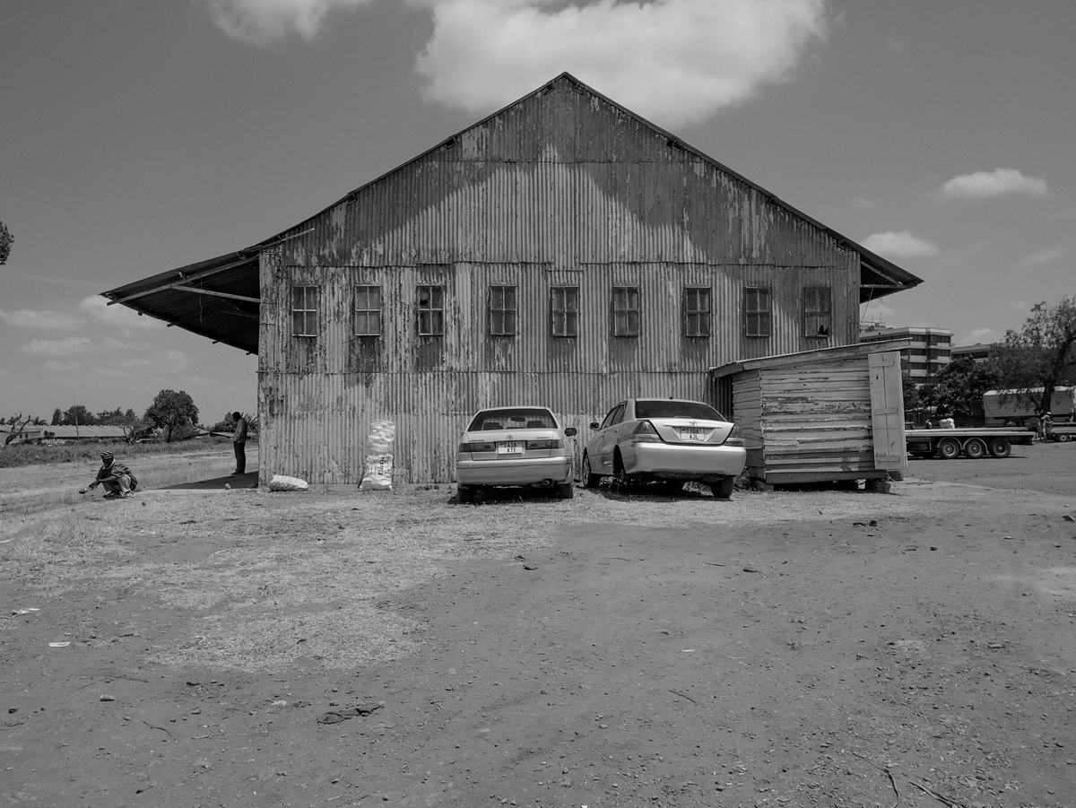
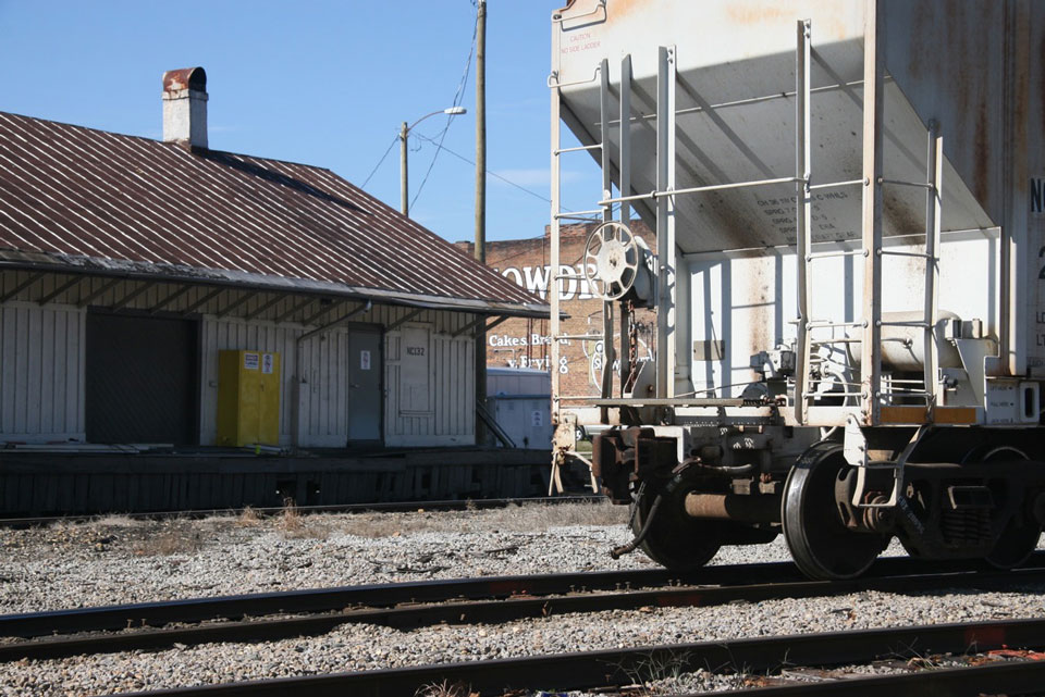
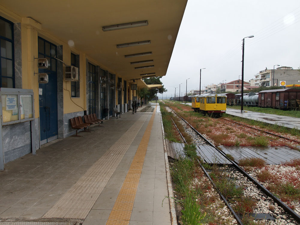
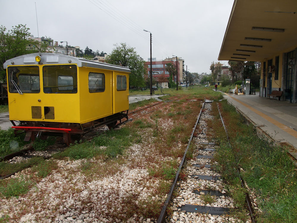
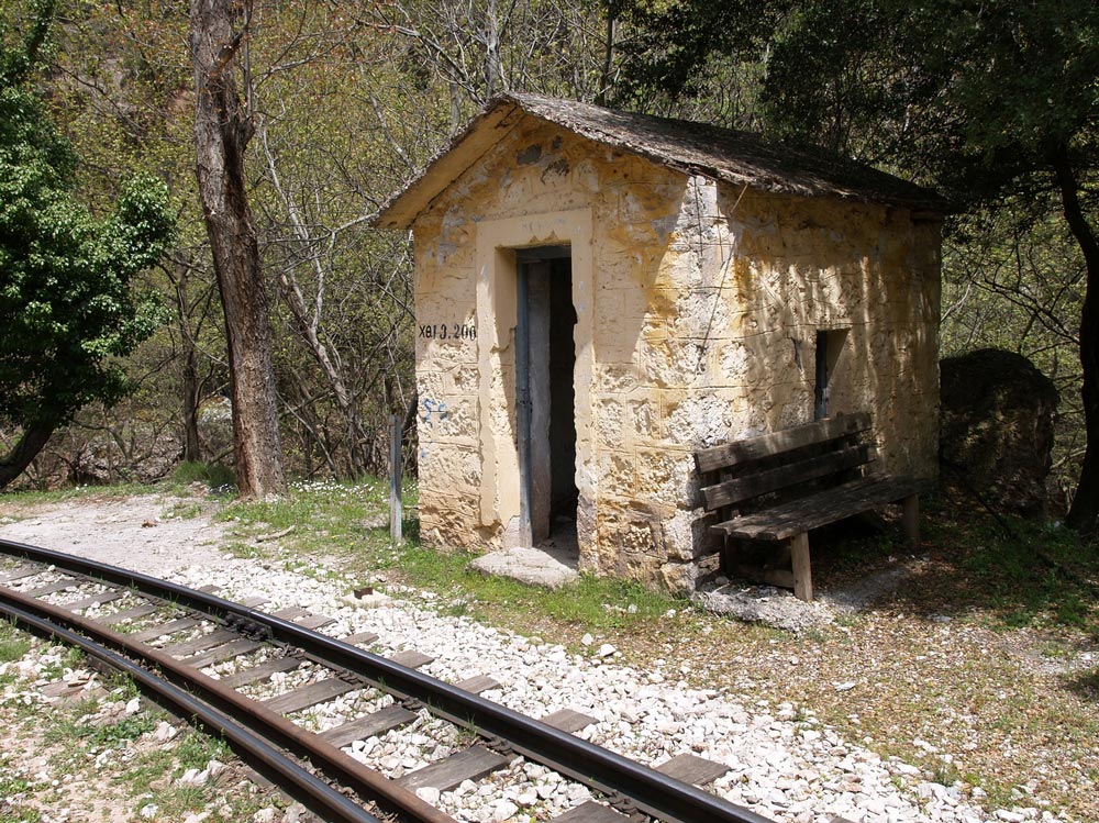
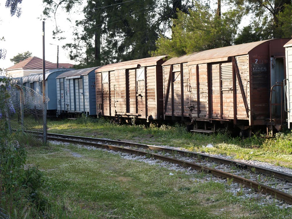
In 2011, the rail yard was pretty quiet, with abandoned rolling stock sitting on sidings. The arm sticking out in front of a graffiti-covered box car is an old water tap for filling the tenders of steam locomotives.

P4271861_RR_Sta_Korinthos__110427_resize_web

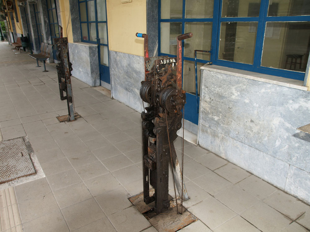
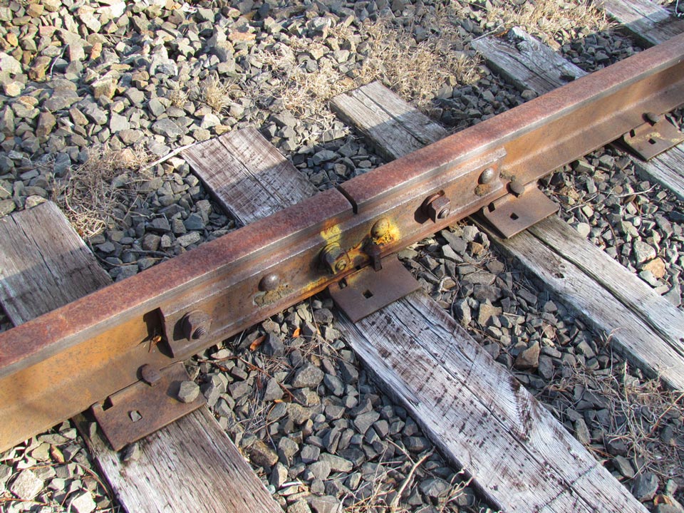
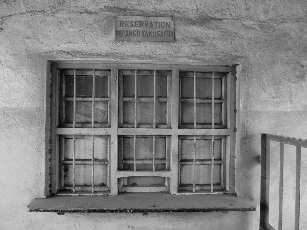
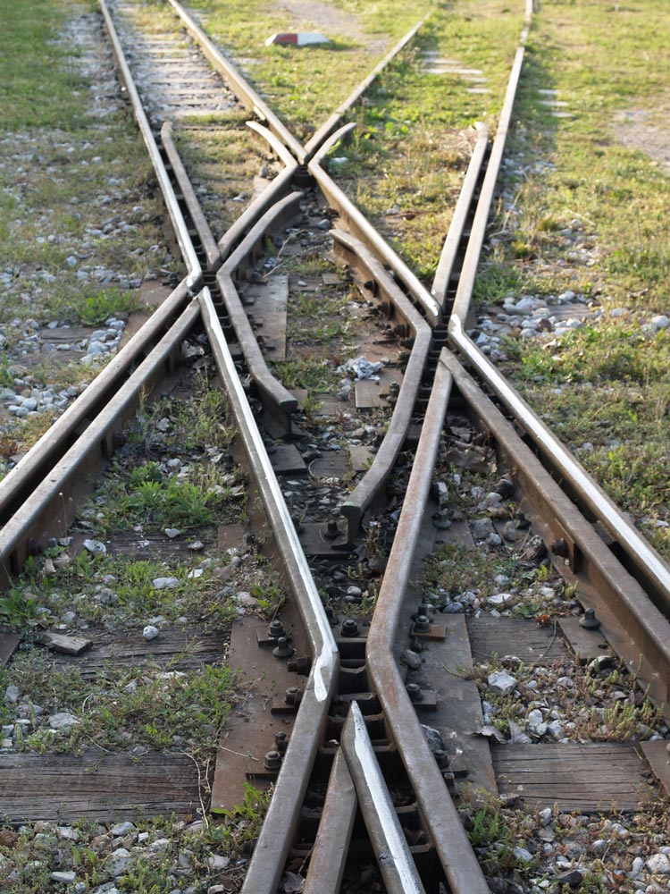
Finally, these mechanical control units actuated track switches. Oddly, they were on the platform in front of the station waiting room. Wouldn’t tourists be tempted to fiddle with them? It’s strange they had never been electrified or adapted to control from a central control room.


The Kalávryta Narrow-Gauge Rack Railroad
Peloponnese, Greece

Kalavryta-map_web

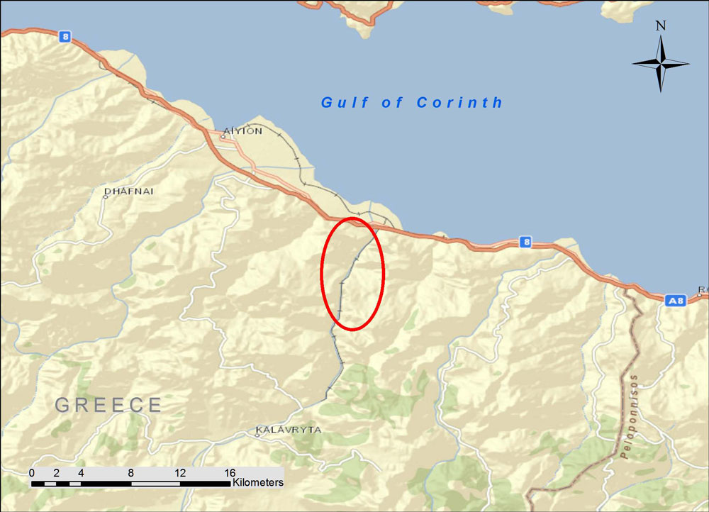
The Kálavrita (Καλάβρυτα) Railway was engineered by an Italian company in 1885-1895 in the fantastic gorge of the Vouraikós River. The original steam locomotives are long gone and have been replaced with modern diesel-electric cars, but nothing detracts from the magnificent scenery or from the achievement of the engineers some 120 years ago. The route starts in the coastal town of Dhiakftó and proceeds south (uphill) through the gorge to a high fertile plateau. Kalávryta is in the East Central part of the prefecture of Achaea. You can drive there through the mountainous and scenic Peloponnese, but many people opt to park their car at Dhiakftó and take the famous train for a day-long excursion.

IMG053_Kalavryta-RR-sta_820413_resize_web

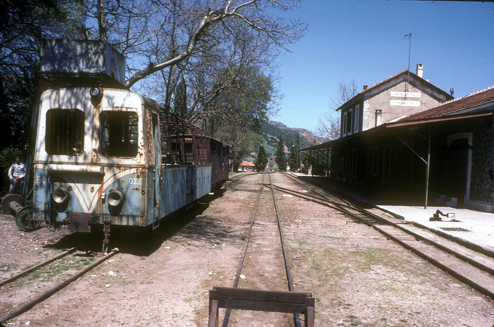
This is the station in Kalávryta (2480 ft altitude). Although in use on weekends, it is pretty quiet and has a lost-in-time look to it. The town is historically noteworthy for two events. First, at the nearby Monastery of Ayia Lávra, Germanos, the Bishop of Patras, raised the flag of revolution against the occupying Turks on March 21, 1821. This eventually led to Greek Independence. The second event is more tragic. On December 13, 1943, German occupying troops massacred 1436 males over the age of 15 and burnt the town (from Blue Guide Greece, 1973 edition).

Morang_1982_004_adj_resize_web

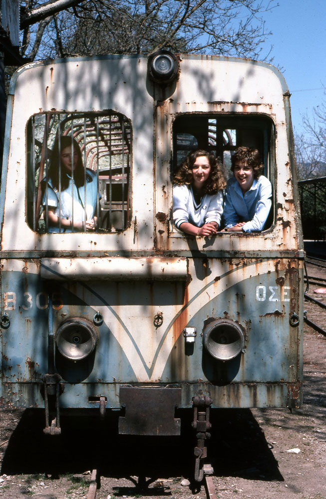
Here are the young beauties in the old rail car.

P4251816_Kalavrita_RR_110425_resize_web

DSCF0282_KalavritaRR_080430_resize_web

P4251815_Kalavrita_RR_110425_resize_web

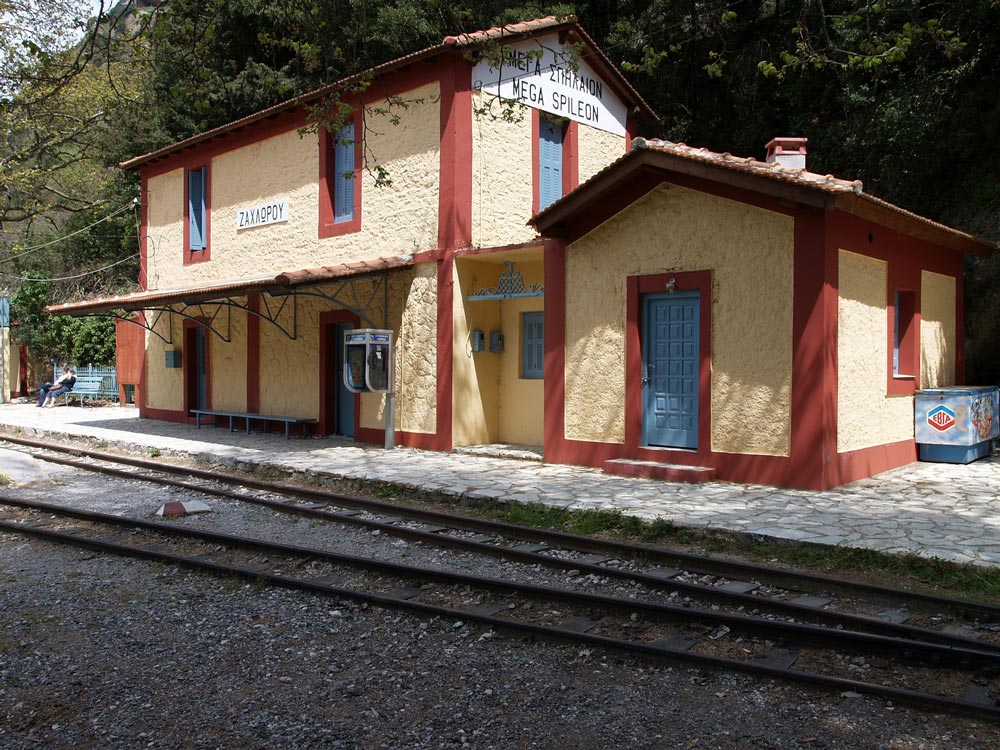
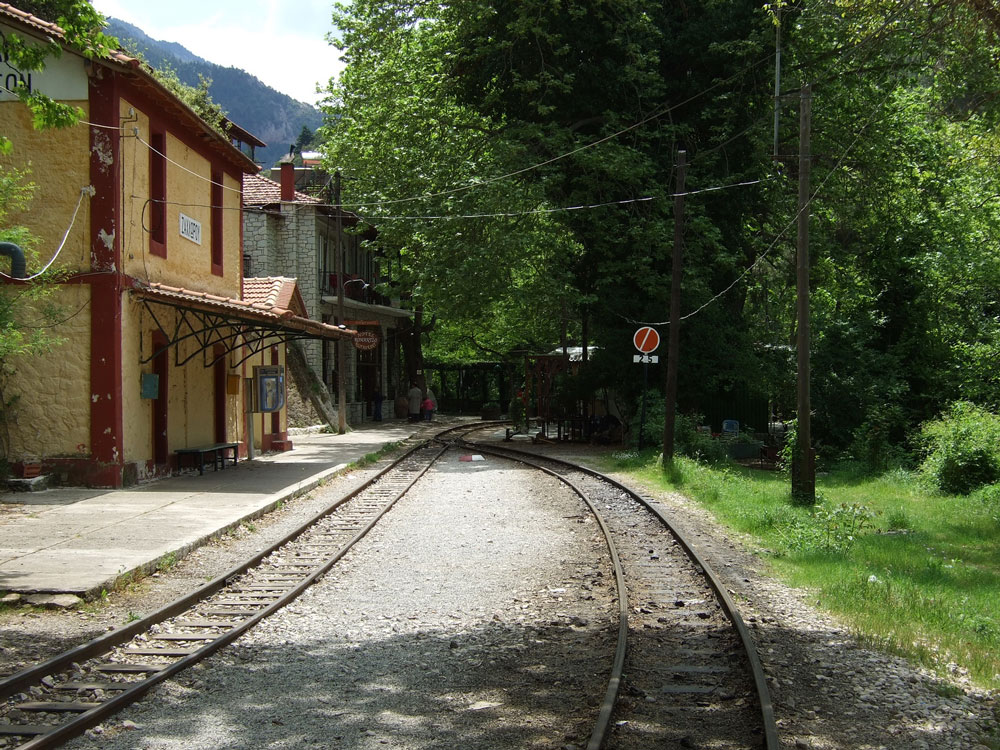
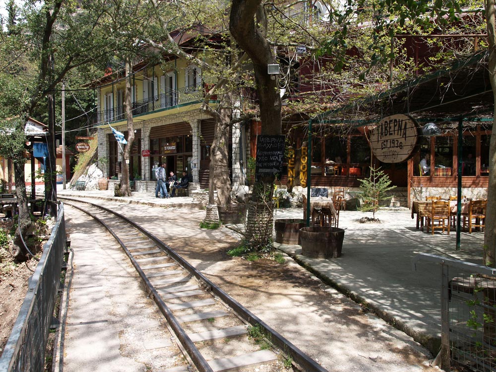
Zachloroú is the first stop north of Kalávryta, where many people get off the train and hike downhill through the gorge. In my case, I took a taxi from the coast to this station to begin the hike. The route is part of the E4 European long distance hiking path (if you are really energetic, you can walk the E4 from Tarifa, the southernmost point of mainland Spain, to Crete!). There are two tavernas right at the edge of the rail line. One of them specializes in delicious roasted rooster and local retsina, where you can fortify yourself with calories in preparation for the 4-hr trek. One of the nice things about travel in Greece is that even small rural places prepare amazingly good food. There is also a nice little hotel if you want to stay the night (perhaps you had too much retsina…).

P4251817_Kalavrita_RR_110425_resize_web

P4251814_Kalavrita_RR_110425_resize_web

DSCF0286_KalavritaRR_080430_resize_web

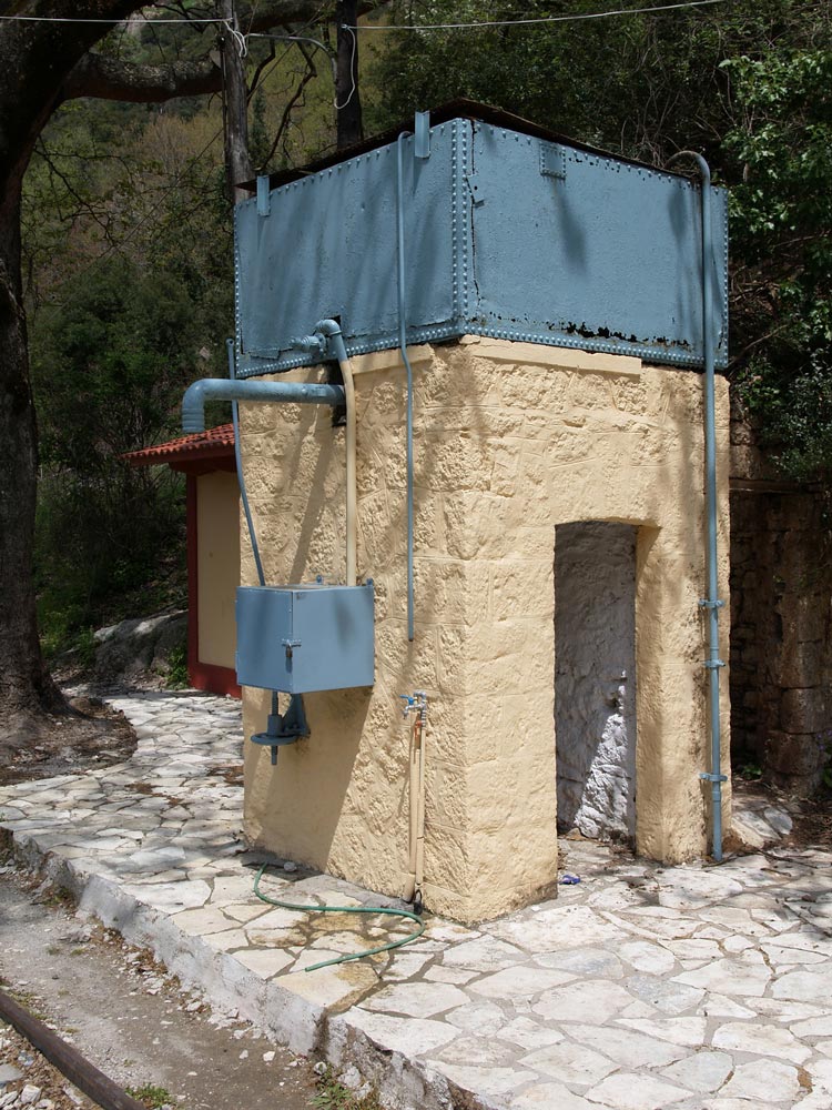
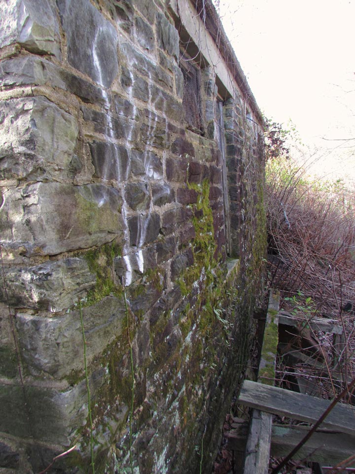
As you proceed downhill, you pass stone work sheds and water tanks, which have been restored and painted. The Ο.Σ.Ε. must have put a lot of money into the project.

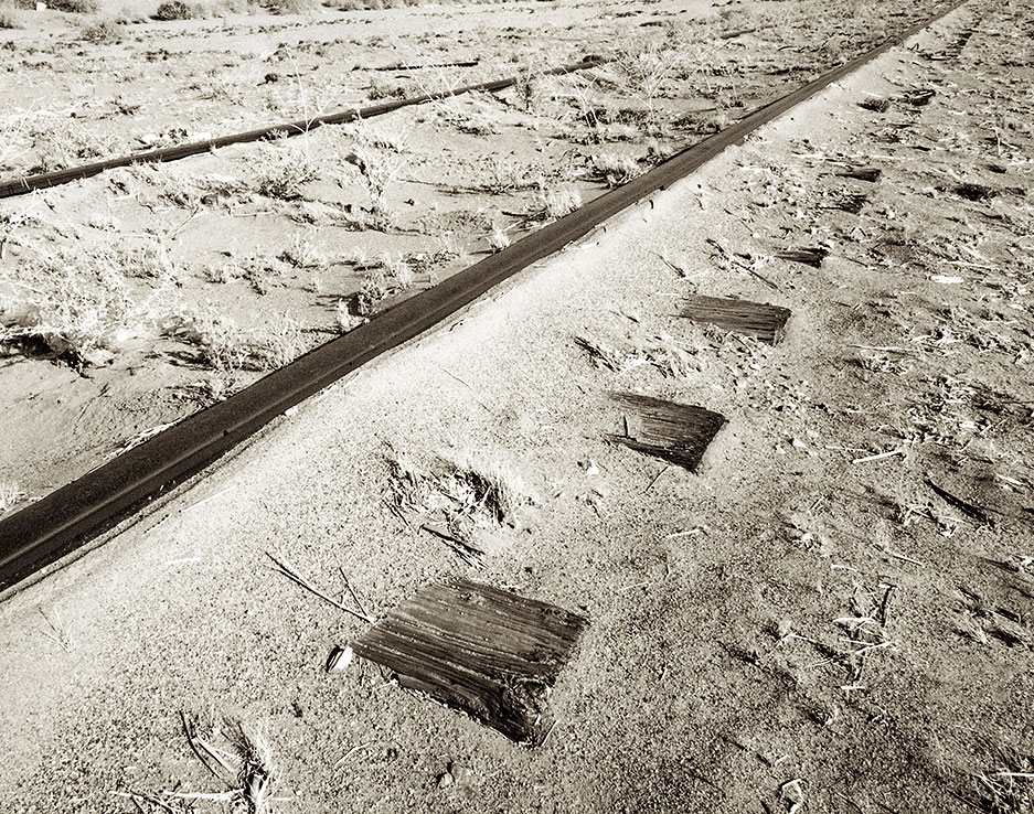
All the track was replaced in 2008-2010. From Wikipedia: “The railway is single line with 750 mm (2 ft 5½ in) gauge. It climbs from sea level to 720 m in 22.3 km with a maximum gradient of 17.5%. There are three sections with Abt system rack for a total of 3.8 km. Maximum speed is 40 km/h for adhesion sections and 12 km/h for rack sections.” The total route is 33 km.

The gorge gets more and more rugged, and you wonder how the engineers managed to tunnel and bridge their way up this valley. What ambition. The tunnels are interesting because you need to be sure you are not in one when the train comes. The first time I walked the route in 2008, the system was closed while the tracks were being replaced, but the next time, I had to remember to look for the train. It’s really not a problem except for the bridges and tunnels.

Finally, as you approach the coastal plain, the gradient levels out and you have an easy walk to the depot in Dhiakftó. The geology is also fascinating, and you pass through regions of conglomerate, sandstone, limestone, and alluvial outwash.

P4251824_Kalavrita_RR_110425_resize_web

P4251825_Kalavrita_RR_110425_resize_web

At Dhiakftó, the excursion train meets the main Athens-Peloponnese line (also narrow-gauge). A new full-gauge rail is being built to connect to Patras, but I do not know if the new line will come to this rail yard or be routed further inland.

(This is Part 1 of a two part article on the Railways of Greece. Be sure to check back next Thursday for Part 2)

Andrew Morang – Photographs and text Copyright 2016
See more of Andrew’s work at his blog, Urban Decay.

A Lesson Learned

The sign along the BNSF’s Beardstown Subdivision for the town of Shattuc.

Railroad interlocking towers once dotted the landscape so much that it seemed like they would always be there. Many towers still stand and watch silently as their human operators and the interlocking levers they controlled have been replaced by new technologies controlled from afar. Many other towers have vanished completely, with only a patch of gravel marking the spot where the tower once stood.

In the small, central Illinois town of Shattuc stood one of these towers. For years Shattuc Tower stood as a silent sentinel, watching the trains of many railroads roll by its broken and boarded up windows, its interlocking levers frozen in place from when the tower was decommissioned and the tower operator walked out of the tower at the end of the very last work shift. In its heyday the tower controlled the movements of the Chicago, Burlington, and Quincy and the Baltimore and Ohio Railroads. In later years the tower stood guard over the Burlington Northern and Chessie System, before being closed sometime in the 1980s. After being closed, CSX and Burlington Northern Santa Fe (BNSF) trains rolled past the unused tower on the CSX’s Illinois Subdivision and the BNSF’s Beardstown Subdivision.

Looking southeast toward Shattuc Tower
Looking south along the BNSF’s Beardstown Subdivision
Looking east along the CSX’s Illinois Sub. (Now out of service)

Today the tower is gone, and one of the two rail lines it once controlled is no longer a through route. Shattuc Tower was torn down in December 2014, after having stood as an empty, silent sentinel for many decades. In 2015, in a filing to the Surface Transportation Board under STB Docket No. AB-55 (Sub-No. 748X), CSX requested and received approval to discontinue service on its Illinois Subdivision between Caseyville, Illinois and Aviston, Illinois. Because of this, the rest of the subdivision now lies dormant with an uncertain future. However, BNSF trains still ply the rails of the Beardstown Subdivision, rolling past the empty spot where the tower once stood.

Looking east down the CSX Illinois Subdivision., with the interchange track in the foreground
Looking west down the CSX Illinois Subdivision., with the interchange track in the foreground

When I came across Shattuc Tower back in 2005, the abandoned railroad tower grabbed my attention more than the previous abandoned railroad towers, depots, and stations I had come across. Previous to coming across Shattuc Tower I had never thought much about these by-gone structures disappearing, which is a shame because so few of them are still standing and even fewer are being used. Shattuc Tower made me realize just how important it is to document the railroading environment as a whole, rather than just locomotives and the rail cars they move. The tower had stood watch along with its operators for so many years and then in the blink of an eye it was abandoned. This abandoned state was to me a reminder of just how quickly life can change after being the same for so long. The tower was a reflection of life and how the advancement of technology changes how people interact with their world. Before being torn down, Shattuc Tower taught me the valuable lesson to get out and document what I can because what is standing today may not be standing tomorrow.

Looking northwest at the tower at sunset. The BNSF’s Beardstown Sub. crosses left to right over the CSX’s Illinois Subdivision

Tom Gatermann – Photographs and text Copyright 2016

Ghosts of Winslow Junction

Winslow Tower - PRR styling, P-RSL ivy green.
Winslow Tower – PRR styling, P-RSL ivy green.

Winslow Junction is located at the edge of the New Jersey Pine Barrens almost exactly half way between Philadelphia and the resorts in Atlantic City. The site is surprisingly rural for something set in the most densely populated area of the United States. However, 100 years ago Winslow Junction could boast some of the highest traffic densities in the world as two railroads competed to bring millions of middle and working class passengers to the fun and leisure of the New Jersey shore.

In the few decades between the time when workers developed the ability to enjoy leisure time in the late 19th century, and when private automobiles and inexpensive air travel expanded their options in the mid 20th, Atlantic City was one of several resort cities that owed their fortunes to efficient rail transport. Like Brighton Beach, New York and Brighton, England, Atlantic City relied on a conveyor belt-like system of trains that whisked holiday seekers from the urban core to the beach in the brief period when they were released from their jobs. Winslow Junction sat at the nexus of this system, located at the point where the Central Railroad of New Jersey’s Southern Division crossed both the Camden and Atlantic (PRR) and Atlantic City Railroad (Reading) main lines. It was also the point where the ACRR’s Cape May branch split off from their Main Line with additional connections to the CNJ for its famed “Blue Comet” express service to New York City.

winslow
WINSLOW interlocking as it existed in 1968 after the initial round of cuts.

Improving road transport brought rapid change to the Atlantic City travel market and in 1933 the competing Pennsylvania Railroad and Reading System operations were merged into the Pennsylvania-Reading Seashore Lines. In 1934 the state of the art WINSLOW tower and its associated interlocking was constructed to bind the system together at its nexus point, replacing older mechanical towers and antiquated signaling. The air operated switches and cab signals were installed on over 5 route miles of track, all controlled from a single power interlocking machine in a brand new brick tower.

However the story of Winslow Junction from then on would be mostly one of decline. As Atlantic City faded, tracks were cut back and the main lines were downgraded. Finally, in 1983. passenger service to the shore was suspended and the interlocking plant in the middle of the Jersey pines was shuttered for good. Fortunately, state ownership meant that the artifacts were largely left in place. Reconstruction of the Atlantic City rail line in 1989 swept away some of the decay, but the tower’s unbroken windows still let in sunlight to shine on the Model 14 interlocking machine for nearly 20 years before they were boarded up.

Windlow Tower northbound with its replacement, NJT's SOUTH WINS interlocking.
Winslow Tower northbound with its replacement, NJT’s SOUTH WINS interlocking.

The main line to Atlantic City that in its heyday hosted the fastest scheduled passenger train service in the world is now a single track line with short passing sidings and a top speed of 80mph. The interlocking that remains in sight of the tower is just a single crossover at the south end of one of those sidings. The former southward main is now just a glorified storage track, albeit one sporting 136lb main line rail with some joints still still paper thin.

Rusted 6-bolt main line rail on the storage siding.

Year by year, bit by bit, more of Winslow’s history succumbs to collectors, vandals and nature. The telegraph poles have fallen to those interested in the copper wire or blue glass insulators. The power supply was bulldozed for PCB remediation and even the half mile long ramp for the Cap May flyover was completely harvested for its supply of high quality construction sand.

Cape May Branch flyover, abandoned in the late 1950's as shore traffic declined.
Cape May Branch flyover, abandoned in the late 1950’s as shore traffic declined.

If anything, Winslow Junction is a testament to the force of nature to reclaim that which humanity tried to assert its dominance over.

A PRR style signal ladder is all that remains of the 10L signal on the flyover bridge.

At the same time it is a testament to those materials of the analogue age that continue to resist the forces of nature, decades after being left to fend for themselves. Creosoted wooden ties, lead painted pipelines and even rust covered structural steel still stand strong.

WINSLOW-old-8R-lower-head-remains
Lower head of old 8L signal

Many of the classic PRR position light signals at Winslow Junction were salvaged by local railroad enthusiasts during the Amtrak rebuilding project in the late 1980’s, however the former 8L signal stationed at the south junction of the connector track was rolled down the embankment to fade away.

NJT_9903-angle
Abandoned Maintenance of Way flatcar

The track connecting the former Atlantic City Line to what became the Conrail Beesley’s Point freight line saw a brief resurgence after the tower was closed as it was the only way that Atlantic City bound freight traffic could access the line after the portion between the Delair Bridge and Winslow Junction was taken out of service.  When the line was rebuilt the interchange moved to SOUTH WINS interlocking and the S-curving connector was left to the weeds.   In addition to the rails, this NJT friction bearing M of W flatcar found itself stuck in time.

The 1934 southbound P-RSL Cape May ramp ducks under the older connection between Reading and PRR main lines. The pipe carried the compressed air supply to the south end of the interlocking plant.

Winslow Junction was built with no fewer than 6 rail-rail overpasses to allow movements to pass by each other without conflict.  This amount of “flight” is typically reserved for busy urban junctions like Zoo, Harold or Jamaica.  Elsewhere in the country, junctions similar to Winslow would have consisted of flat switches and diamond crossings.

Winslow air line near the top of the Blue Comet ramp.

The air for the switches was supplied by nearly 2.5 miles of pipeline, originating at WINSLOW tower and  then following the CNJ Blue Comet connection up to the ACRR junction before splitting, with one line continuing down the Cape May branch and the other using the connecting track to serve the switches around the flyover bridge on the former PRR main line.   Most of this impressive compressed air system was left in place where it is slowly being covered by leaves and vegetation.

Air line running along the shoulder of the county road close to the tower.

Surprisingly this isn’t the only abandoned pipeline at Winslow Junction.  On the remaining connecting track between the CNJ and Reading are a collection of concrete blocks dating from before even the depression era WINSLOW tower.  These are foundations for the mechanical pipes that ran from the original ACRR Winslow Jct tower to switches and signals on the CNJ connection.

Concrete footings for a mechanical pipeline run down the CNJ connection to the location of the former wye switch where footings for old signals can also be found.
Concrete footings for a mechanical pipeline run down the CNJ connection to the location of the former wye switch where footings for old signals can also be found. While somewhat common overseas, the  last mechanical lever operated switch machine in North America was retired in 2010.
Pipeline footings pointing towards the remains of the old ACRR Winslow Jct tower.

Nearly invisible from the track and ensconced in a thicket of brambles and weeds, the foundation for the 1890’s vintage Reading owned ACRR tower can still be found. The upper level was razed in 1934; the basement continued to be used as a remote relay room and possibly as a secondary air compressor station. Today, still water tight, it is used as a clubhouse for local teens, looking to consume adult beverages away from the prying eyes of adults.

WINSLOW-JCT-base-rear-nb
Winslow Junction is a double accident of history. Constructed in the middle of nowhere to take the masses to the shore in the pre-auto era, it was left to fade away due to having become the ward of a state that couldn’t be bothered to properly dispose of it. Hopefully its secrets will linger on to inspire future generations of trackside explorers.

(All photographs were taken in November, 2015. Click here to view additional photos from Winslow Junction.}

Michael BrotzmanPhotographs and text Copyright 2016
See more of Mike’s work at Jersey Mike’s Rail Adventures

Babysitting and Railroads

My daughter did not plan very well. She lives in Yuma, Arizona, in the southwest corner of the state, one of the hottest places in North America. She already had two rambunctious boys, ages three and five, and her third was going to arrive in June of 2014. Her husband would be off with his National Guard unit on the baby’s due date, so my wife and I flew down to help out.

Our days mainly followed the same pattern: get up, take the boys outside early in the morning to work off some energy before temperatures hit triple digits, back home to amuse them in the air-conditioned house, out for a little more running around after sunset, and then bed. There wasn’t much time for photography, but there was a little.

I was surprised to learn that Yuma, despite being in this harsh, hot desert (at least in June), is the center of a major agricultural district. During the winter, 80% of vegetables sold in the United States come from the Yuma area, and my daughter’s home is surrounded by citrus farms. Union Pacific has a very busy line running through Yuma, but there are a lot of other tracks around.

The reason Yuma can support all of this farming is the Colorado River, which is one of the few places one can take hot children to cool off. And one spot, a very nice little beach, also features shade cast by two bridges, one highway and one railroad.

View from the river - Yuma, Arizona
View from the Colorado River – Yuma, Arizona

I occasionally had a bit of time to poke around and see what I could find. Near one little collection of spur tracks I found a bit of discarded history.

Cut-Rail,-Yuma,-AZ-web
Cut rail – Yuma, Arizona

One of the main north/south roads through Yuma near my daughter’s house once had a railroad track running right next to it. Sand keeps trying to cover it, but wind won’t let it.

Tracks, ties, sand - Yuma, Arizona
Tracks, ties, sand – Yuma, Arizona

The two boys were scheduled to attend Vacation Bible School. My daughter wasn’t sure how she would get them there, since by then the baby had arrived. Sensing an opportunity, I volunteered to take them, since I could roam with my camera for two hours, and then go back to the church and pick them up. One evening, I visited the top of the bridge we had played underneath a few days earlier.

Eastbound off bridge - Yuma, Arizona
Eastbound off bridge – Yuma, Arizona

Another evening, I went scouting, and found a signal bridge with interesting possibilities. The next night, I took a good book and a jug of water, went back to the bridge, and waited. An eastbound train came at just the right time.

Eastbound under signals - Yuma, Arizona
Eastbound under signals – Yuma, Arizona

Rob Richardson – Photographs and text Copyright 2016
See more of Rob’s work at Where Trains Were

Last Train to Arusha

Railroad station, Arusha, Tanzania

Dear Readers, sorry, the title is a bit deceptive. There are no trains to Arusha, and I think the last one left the station at least a decade ago. Arusha is a bustling commercial city in north central Tanzania. Most western visitors know it as a gateway to safaris in the Tanzanian game parks or as a gathering point before a climb of Kilimanjaro. Arusha itself does not offer much for the tourist, but it is busy, noisy, and colorful.

Railroad station, Arusha, Tanzania

The railroad was built in the early 20th century, during the great era of railroad-building around the world. The official Tanzanian railroad web page states, “Construction of the 86.08 km Moshi-Arusha railway extension of the Tanga Line starting at Moshi in 1911 and reaching Arusha in 1929. The railway distance from Arusha to Tanga and Dar es Salaam is 437km and 644km respectively.” My guide, Morris, said the railroad was built by the Germans. He was partly correct because while the Germans were forced out of their African colonies in World War I, they certainly began the construction project when Tanzania was part of German East Africa. According to Wikipedia, Germany controlled this part of east Africa from the 1880s to 1919, when, under the League of Nations, it became a British mandate.

Railroad station, Arusha, Tanzania

On my first day in Arusha, I asked Morris to take me to the train depot. He was surprised, and said he had never had a tourist ask him to go there. We took rides with rent-a-motorbike transport guys. Mine had a spare helmet and was very careful, avoiding the rain gutters that line most of the roads. Some of these are serious troughs, about a meter deep and lined with organic debris of unknown aromatic origin. The depot buildings are in a warehouse part of town. Lorries were parked in the dust.

Railroad station, Arusha, Tanzania

The buildings were intact and secure, so someone still takes responsibility.

Railroad station, Arusha, Tanzania

The tracks were meter gauge, another remnant of the German origins for this project.

Railroad station, Arusha, Tanzania

Notice there was once first and second class on the train.

Railroad station, Arusha, Tanzania

Some gents were sitting at one of the platforms. Morris asked them if I could take their portrait. They said they did not see many white people (Westerners?) around there.

Railroad station, Arusha, Tanzania

Railroad station, Arusha, Tanzania

It was pretty sleepy on the track side of the depot. The bugs were buzzing, the sun blazing – time for a nap.

Railroad station, Arusha, Tanzania

Railroad station, Arusha, Tanzania

There was not much happening inside, either. The buildings are locked, so someone has possession. I hope they can one day restore train service.

Railroad station, Arusha, Tanzania

Andrew Morang – Photographs and text Copyright 2016

See more of Andrew’s work at his blog, Urban Decay.

Standing Tall

Sanford, North Carolina

Today this noteworthy freight depot is frail, yet still standing tall. It was originally built for the Atlantic Coast Line Railroad, either at the end of the 19th century or shortly thereafter. It stands just south of the brick, 1910 Union Station at the rail crossover of the Atlantic Coast Line and the Seaboard Airline Railroad in Sanford, NC.

IMG_3769

During the first quarter of the 20th century, Sanford was blessed with four railroads converging at the same location; the Seaboard, the Southern, the Atlantic Coast Line and the Atlantic and Western railroads. At that time the town was bursting with commerce more than 50 years after the Civil War.

Presently the freight depot is used for the storage of signal equipment for the Atlantic and Western and CSX railroads. The exact date of the wood frame construction is not known. However, there are pictures of several other freight depots along the line of the Atlantic Coast Line that are of similar shape, dimension and detail. Rumor has it that a roving, gifted black contractor was responsible for their construction.  A wood or coal fired stove used as a heat source was connected to a chimney strategically located at the one-third point of the roof  on all of the floor plans. The generous overhangs supported by large brackets on the east and west elevations are quite distinctive. Evidently the train loading platform was located on the east side while the truck loading activity occurred on the west side. During its later life the structure was expanded to the south until it reached the former Sanford Sash and Blind Company that has since been abandoned. Hence, the change in roof treatment.

IMG_3816

The only question that remains unresolved is why the northwest roof corner was clipped off later in life. My guess is that when CSX absorbed the Seaboard it wanted to maintain its ROW air rights. Nevertheless, in spite of its present physical condition, the hope is that the community will see fit to save this significant landmark that played an important role in the development of a major transportation hub in the center point of North Carolina.

David Kahler – Photographs and text Copyright 2016