Railways of Greece
 Part 2

img364_Milies_Pelio_940609_resize_web

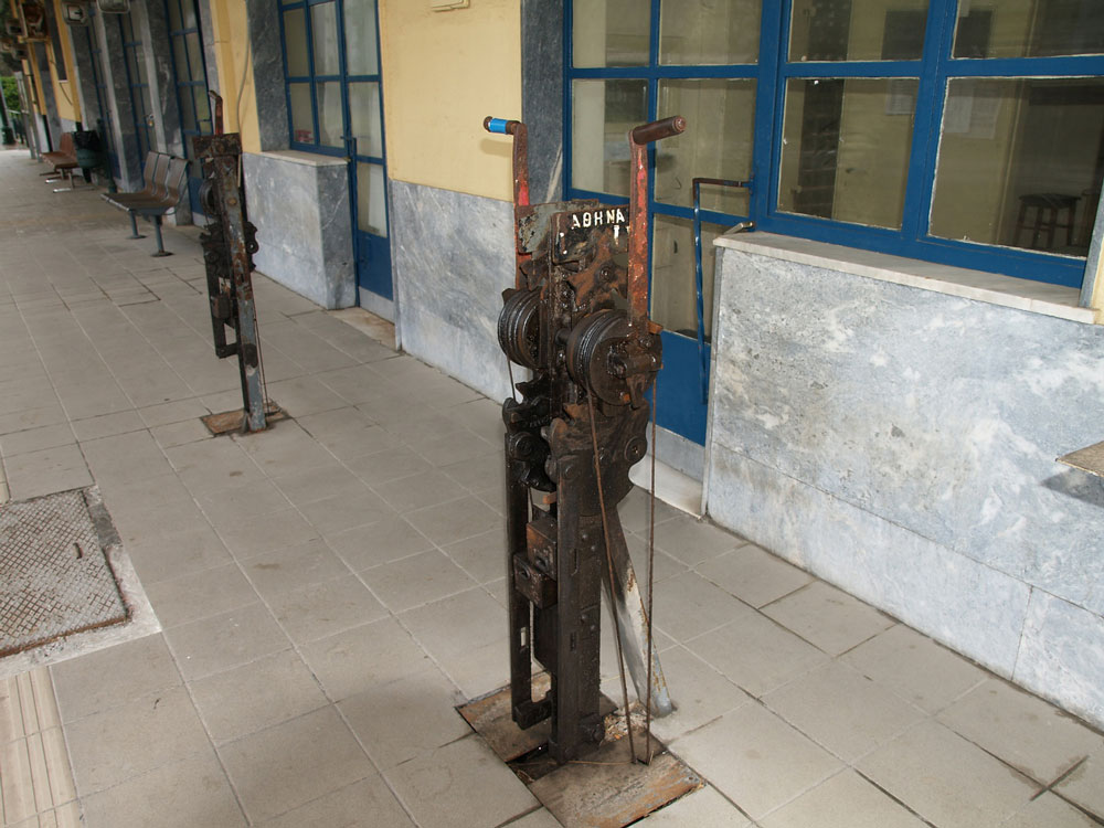
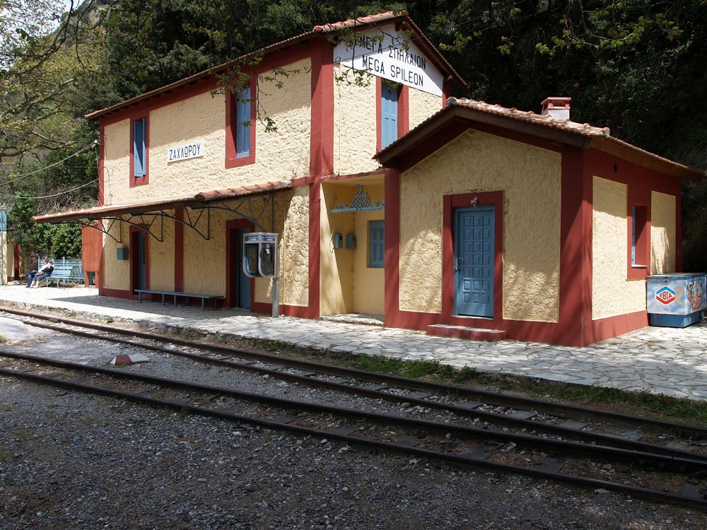
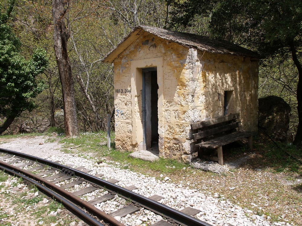
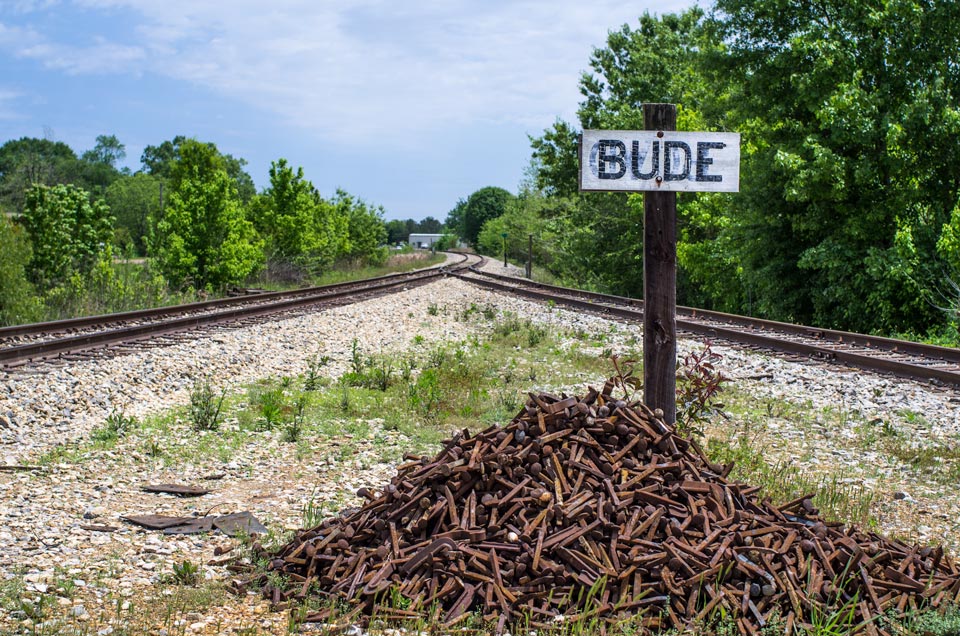
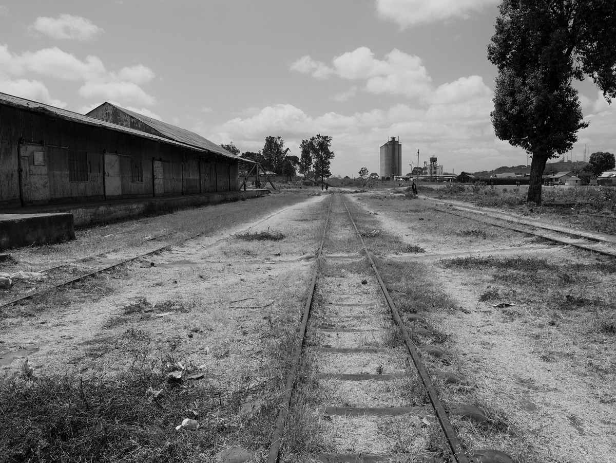
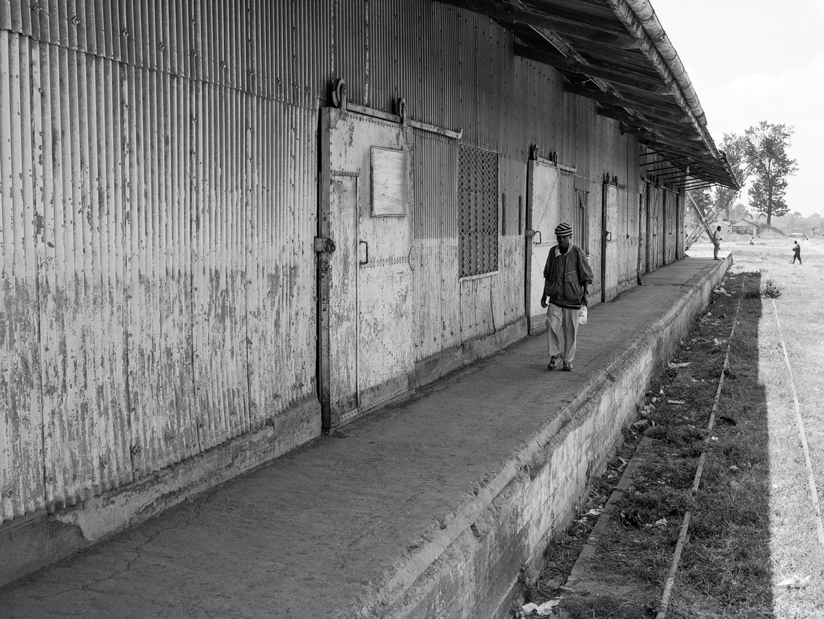
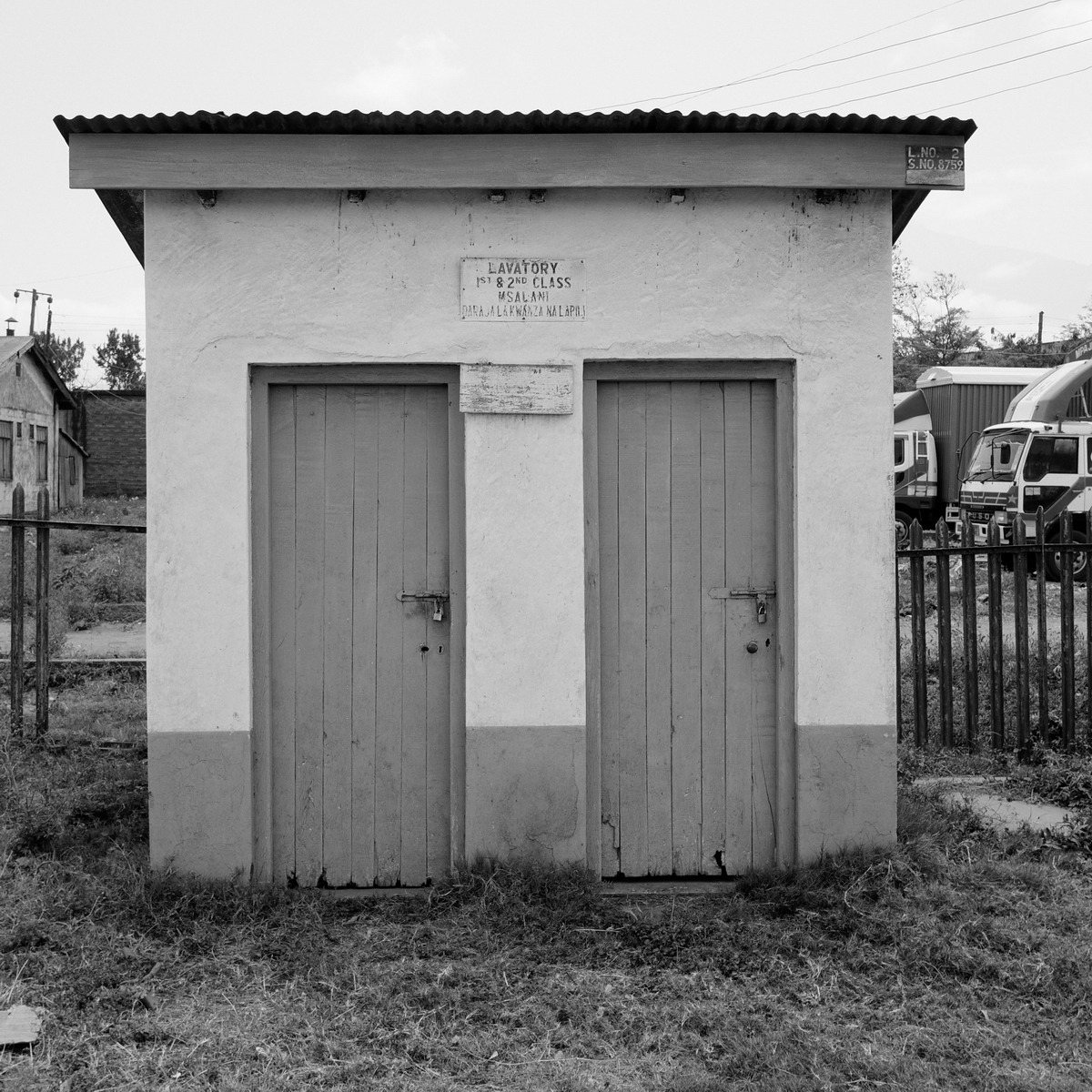
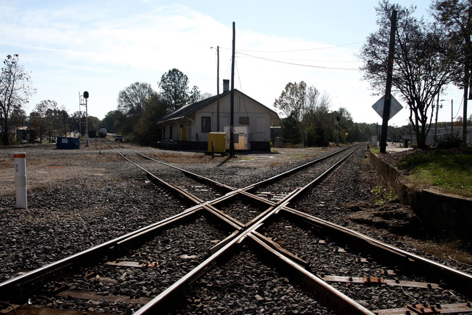
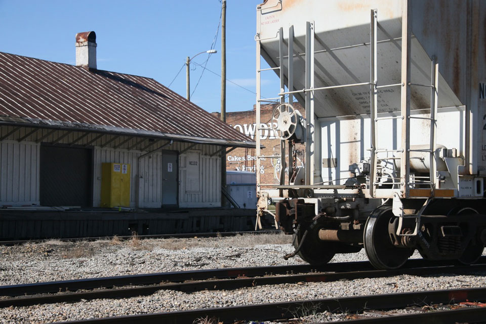
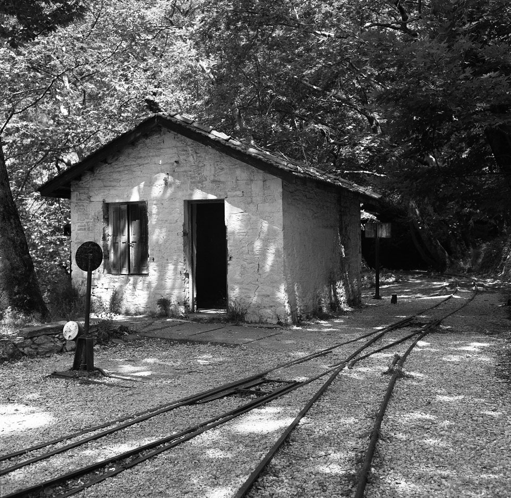
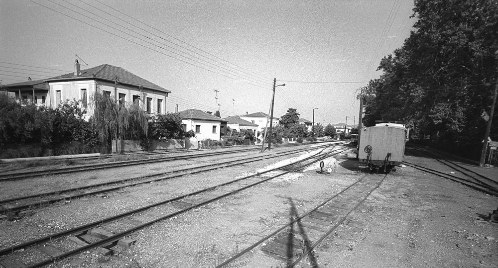
Deserted train station
Milies, Greece

The quiet village of Milies (Greek: Μηλιές) is the end station for the narrow gauge line that runs from the seaport of Volos into the interior of the Pelion Peninsula. Pelio is a rugged, mountainous region in east central Greece.

Pelio_Milies_background

The lush mountainsides are draped with forests of beech, chestnut and plane trees, and the cherries, apples, and apricots are said to be the finest in Greece. Pelio was so rugged, it had little communication with the rest of Greece until the late 1800s. In winter, heavy snow makes roads impassible. During the centuries of Turkish occupation, the Greek villagers here were renowned freedom fighters.

img373_Milies_Pelio_940609_resize_web

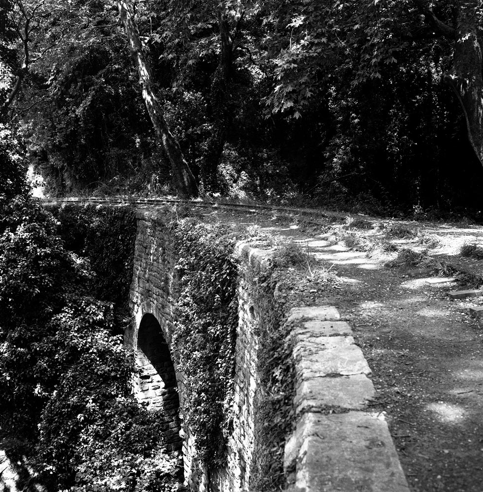
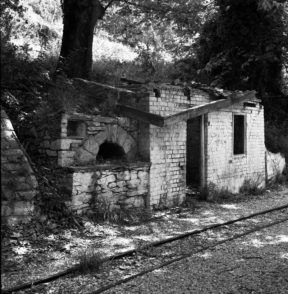
Because access to the mountainous peninsula was so difficult, the goal of the railroad project was to improve transport and integrate the area into Greece’s economy. According to Wikipedia, “The 600 mm (1 ft 11 58 in) gauge 27 km line from Volos to Milies, a distance of 28 km, was constructed between 1903 and 1906 by the Italian engineer Evaristo De Chirico.” Service began in 1906. Construction was very difficult because of the need for six stone bridges, one iron bridge, many protective walls, tunnels, and aerial pedestrian bridges. The photograph above shows an example of the arch bridges, all built by hand by skilled rock masons.

img372_Milies_Pelio_940609_resize_web

img371_Milies_Pelio_940609_resize_web

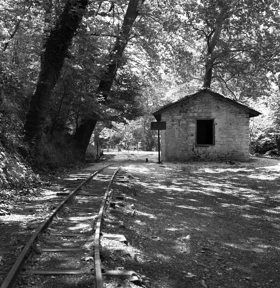
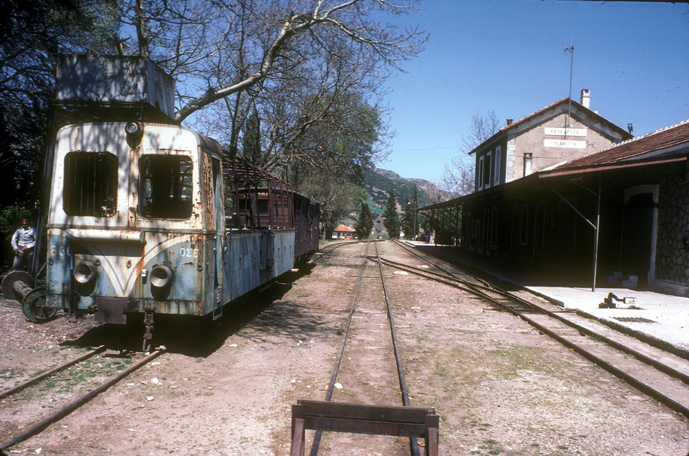
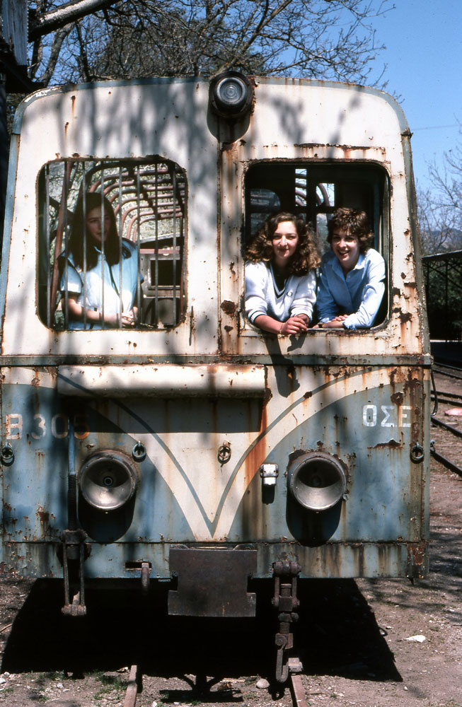
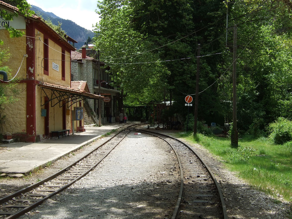
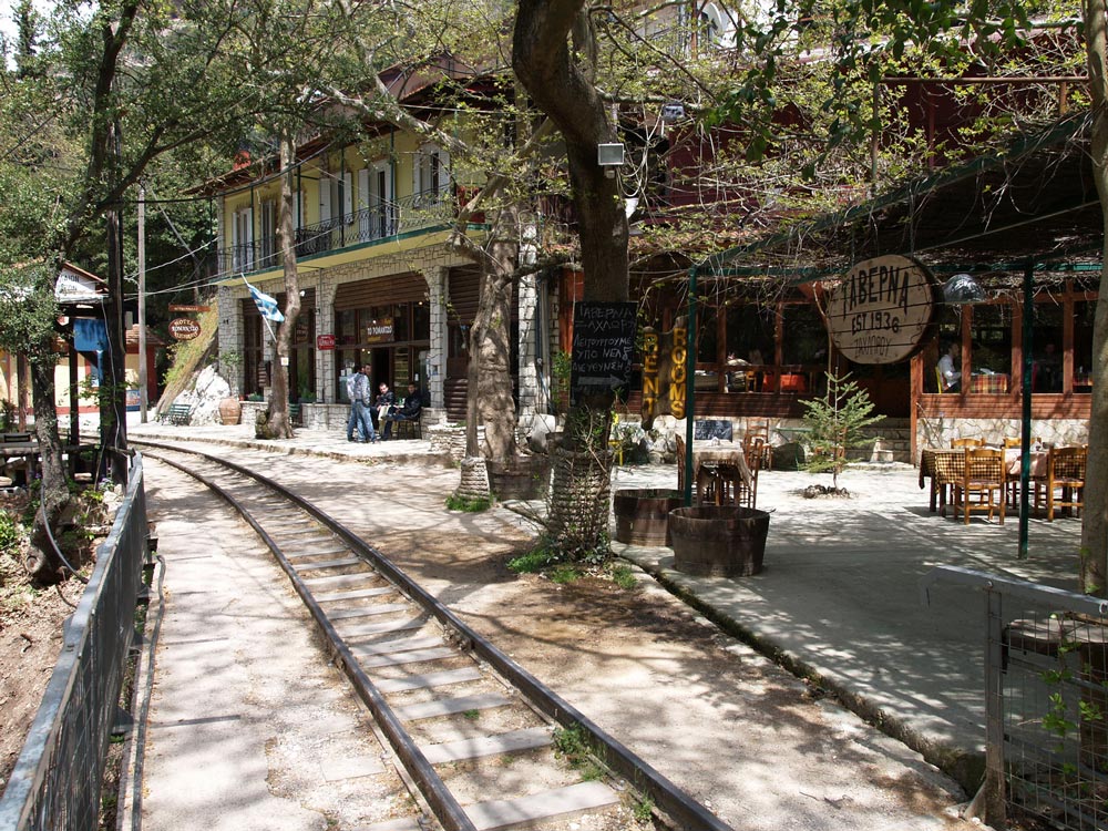
When I took these photographs in 1994, the line was unused and the setting had a charming, sleepy, overgrown look to it. Service was discontinued in the 1970s, but may have been restored recently for steam locomotive tourist trains.

img369_Kissos_Pelio_940608_resize_web

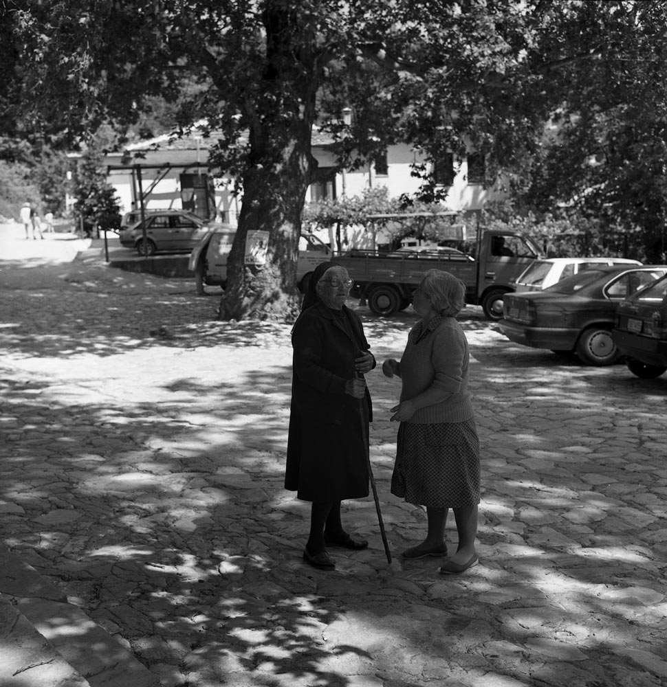
In the 1990s, there was a well-known bakery here where Athenians would buy bread before returning to the city (about a 5-hour drive to the south). The village ladies above had probably seen it all—strange tourists with tripods and cameras, and city-slickers with bags of fresh bread and cherries.


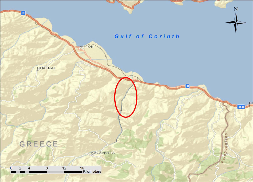
A Ride on the Piraeus, Athens, and Peloponnese Railway

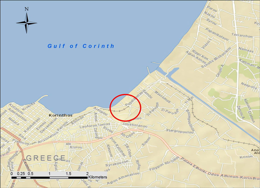
The Piraeus, Athens and Peloponnese Railway was a narrow gauge (1.00-meter) line that once connected small towns in the Peleponnese area of Greece with Athens. Our trip will carry us along the rails from the west end of the Gulf of Corinth to Athens.

Peleponnese-RR-background

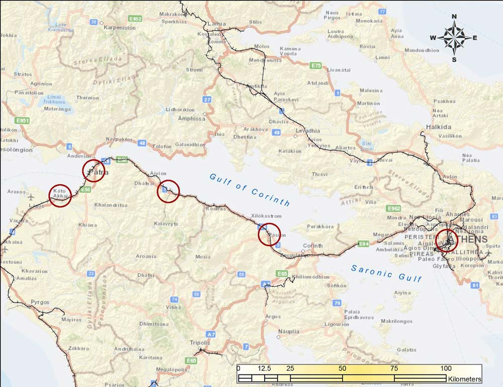
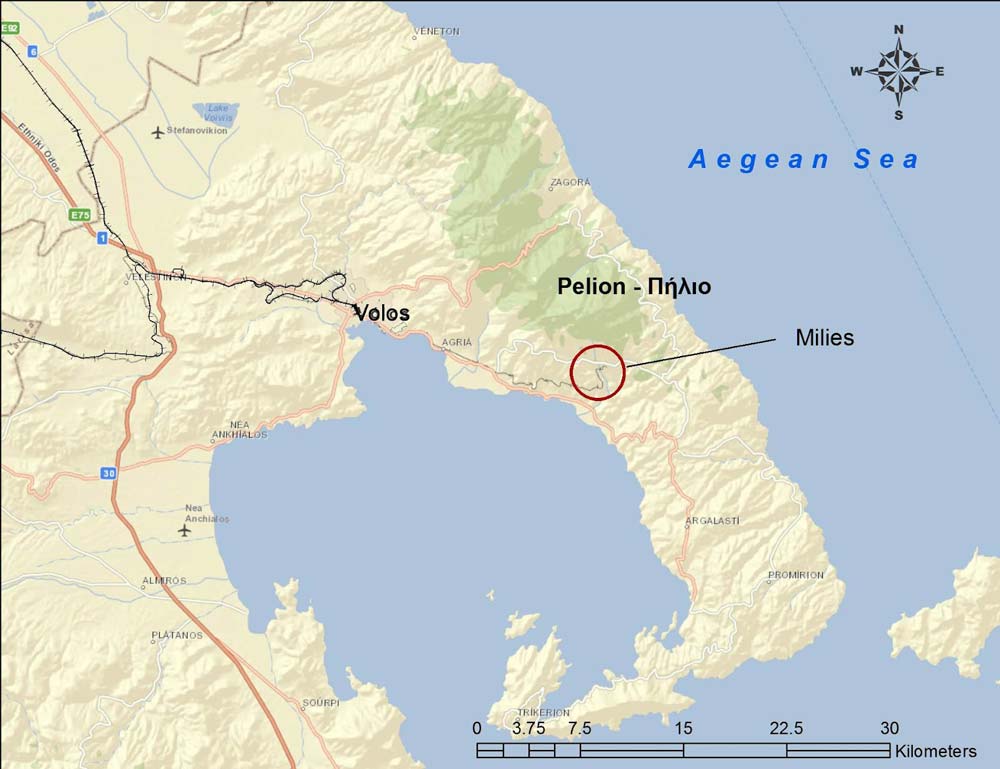
The circles show locations of photographs. Background maps from ESRI Maps and Data.

img351_Axaia_RRsta_970715_resize_web

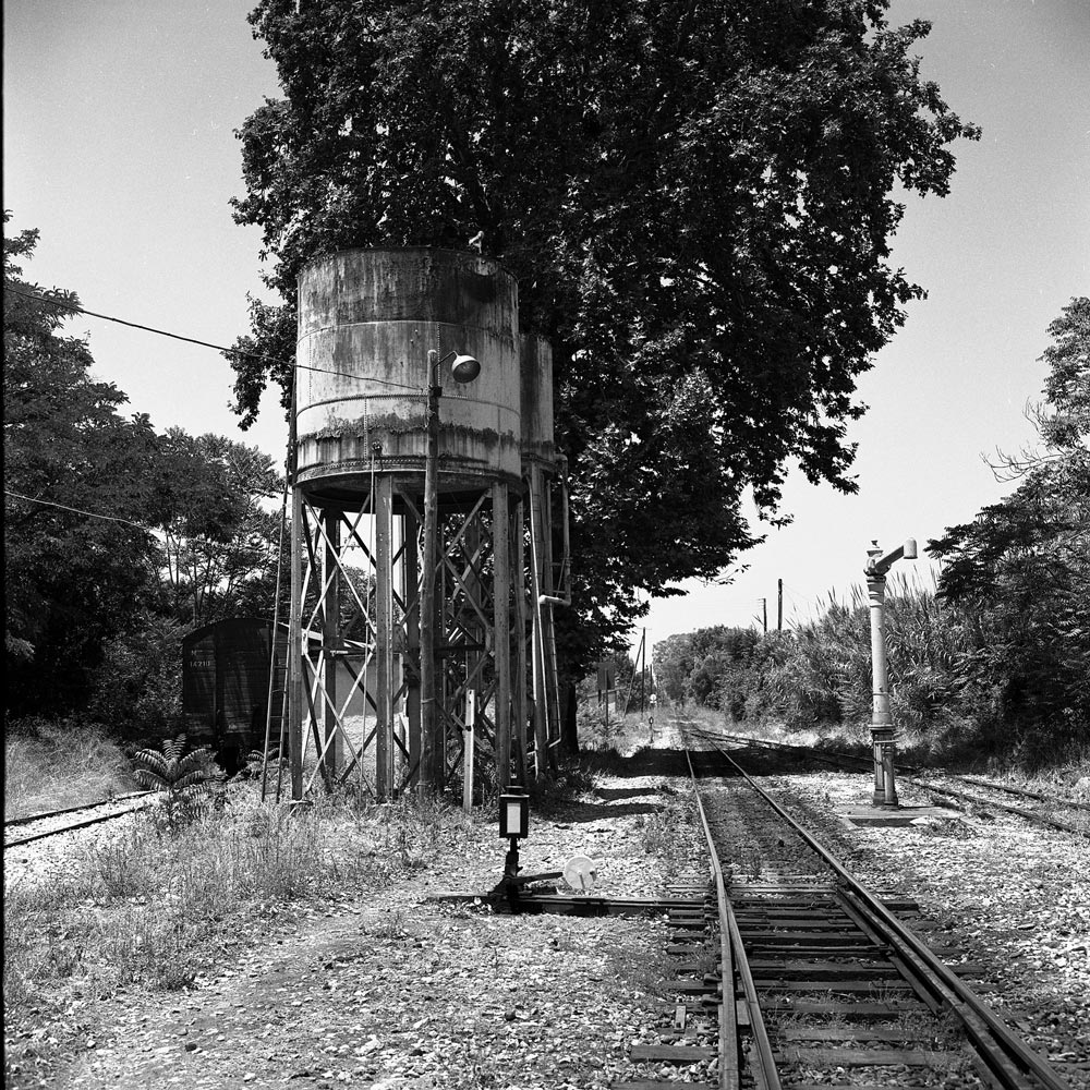
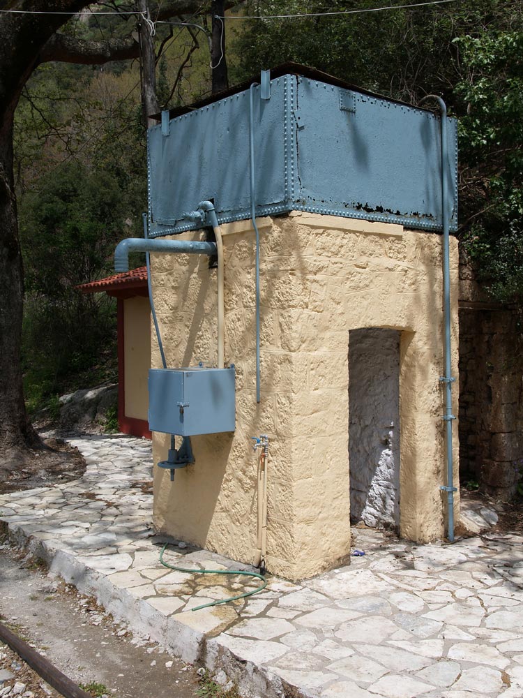
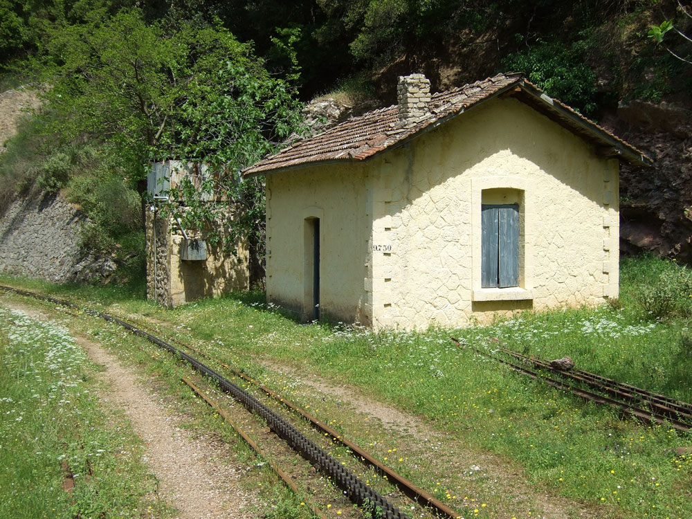
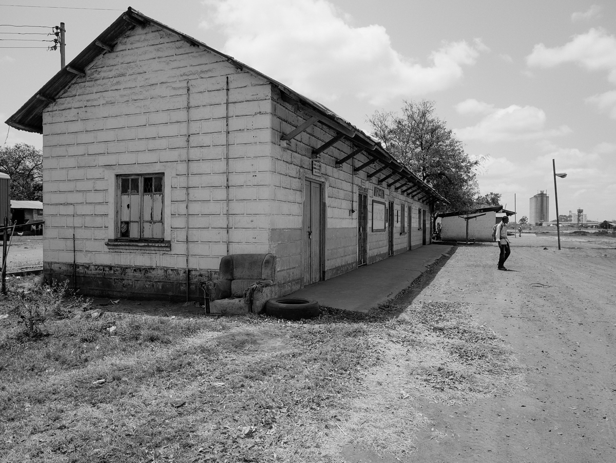
This is the station at Kato Achaia, a farming community west of Patras. It has a sleepy land-that-time-forgot look to it. The water tank for steam locomotives still stands. As I recall, the train was delayed and we sat at a café for an hour or two.

img356_Axaia_RRsta_970715_resize_web

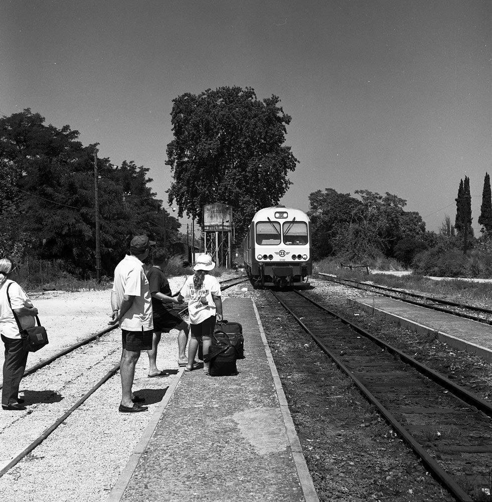
As of 1997, the train consisted of modern but well-used diesel-electric rail cars. The windows were open and the train trundled along through vineyards and orange groves.

img354_Patras_RRsta_970715_resize_web

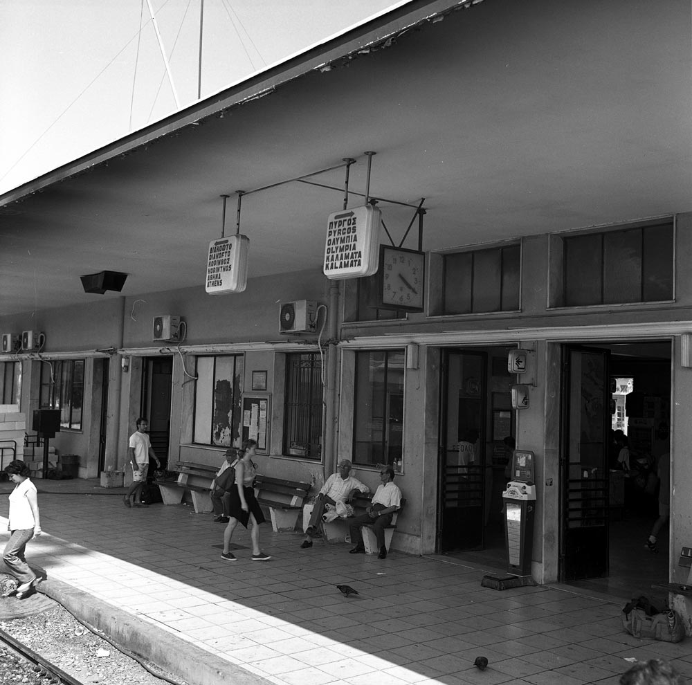
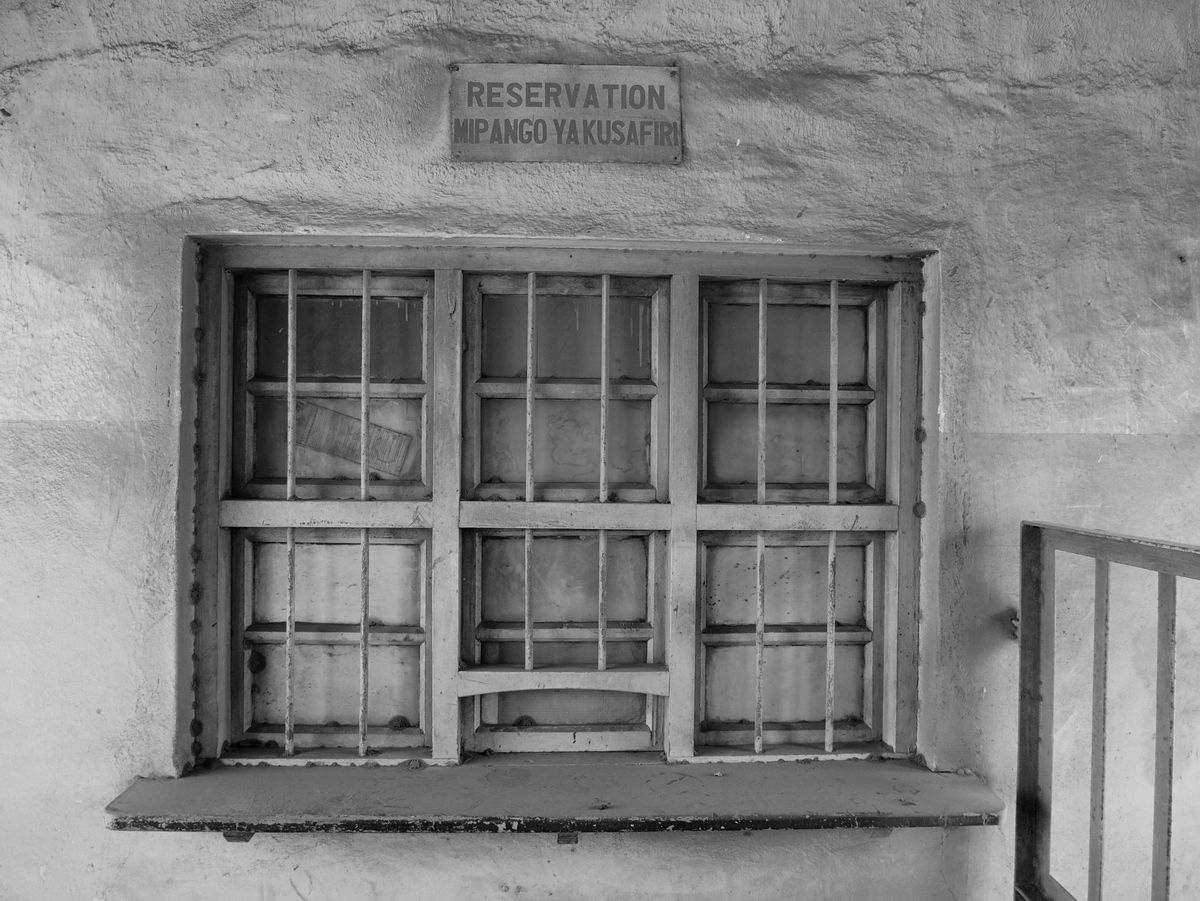
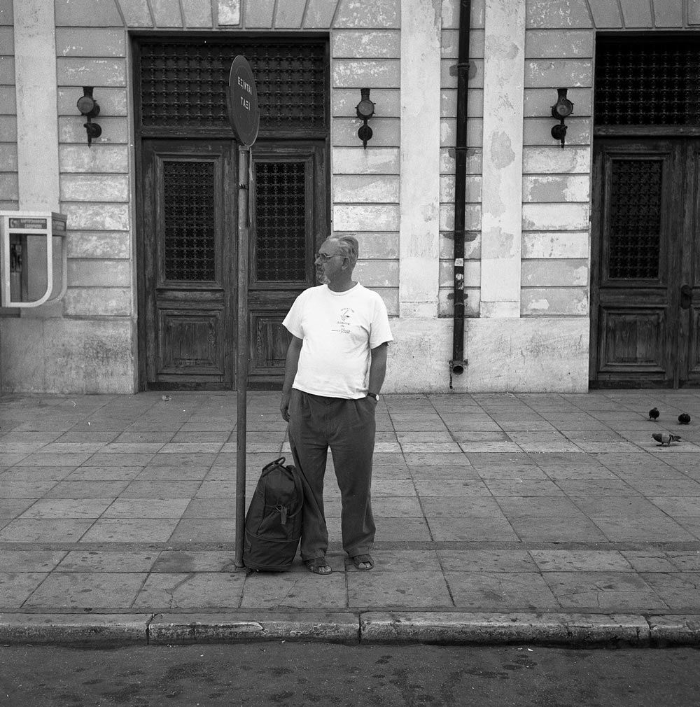
In Patras, we had to change trains for the main line to Athens. This was a busy station because tourists from Italy disembarked from ferry boats and many boarded the train here.

img353_Patras_RRsta_970715_resize_web

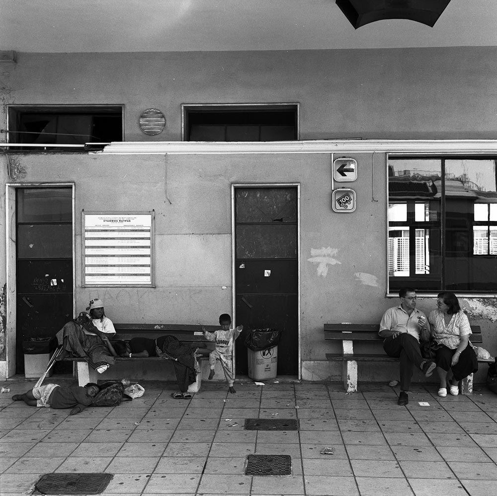
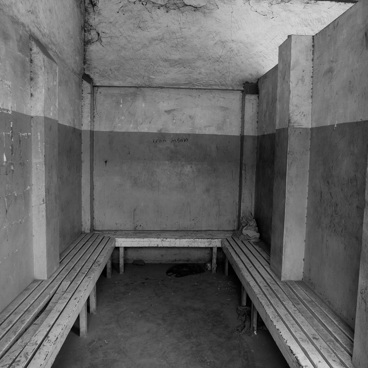
You see some refugees or gypsies on a bench. A historical note: After the Communist Bloc collapsed in 1989, thousands of Greeks from Bulgaria, Romania, and other countries were finally free to return home. Some had been stranded in the Soviet Union since the 1917 revolution. In Czarist Russia, Greeks were an important part of the merchant class and traveled throughout the vast land, but when the Bolsheviks imposed Communism, the Greeks were unable to leave. Many of their descendants spoke no Greek and had not been able to worship in Orthodox churches. After 1989, Gypsies (the Roma) also were able to travel across borders that had formerly been sealed. Finally, Albania, once a forbidden dictatorship every bit as secretive as North Korea is now, collapsed, opening the borders to thousands of impoverished Albanians who desperately wanted to find work in Greece. The people on the bench may be gypsies. These refugees have caused major disruptions to Greek society and its fragile economy.

img352_Patras_RRsta_970715_corrected_resize_web

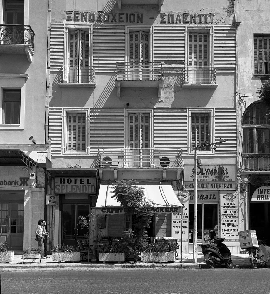
This “Splendid” hotel was across the street from the Patras rail station. It was probably clean enough but noisy; I will pass.

IMG0044_Diakofto_980714_adj_resize_web

The next major junction was Diakopto, where tourists could take the famous rack train up the gorge to Kalavrita.

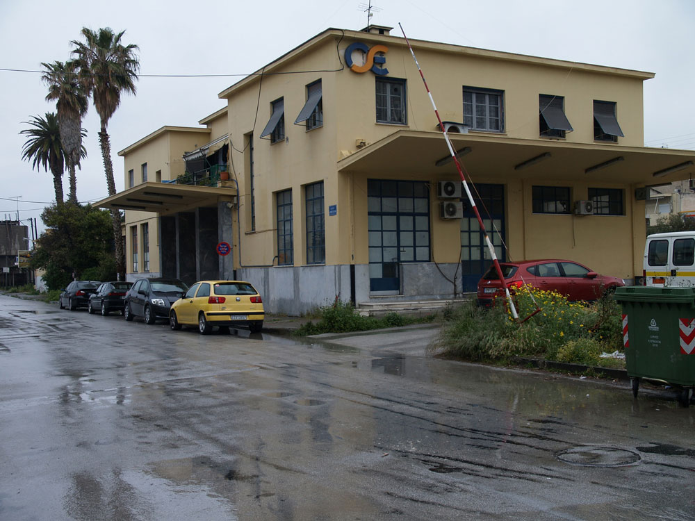
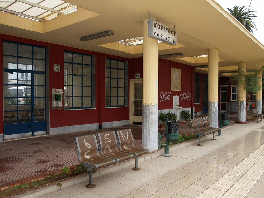
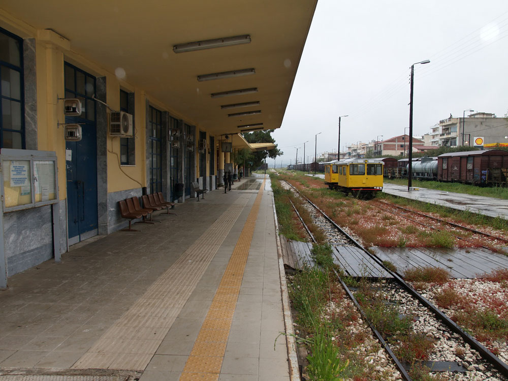
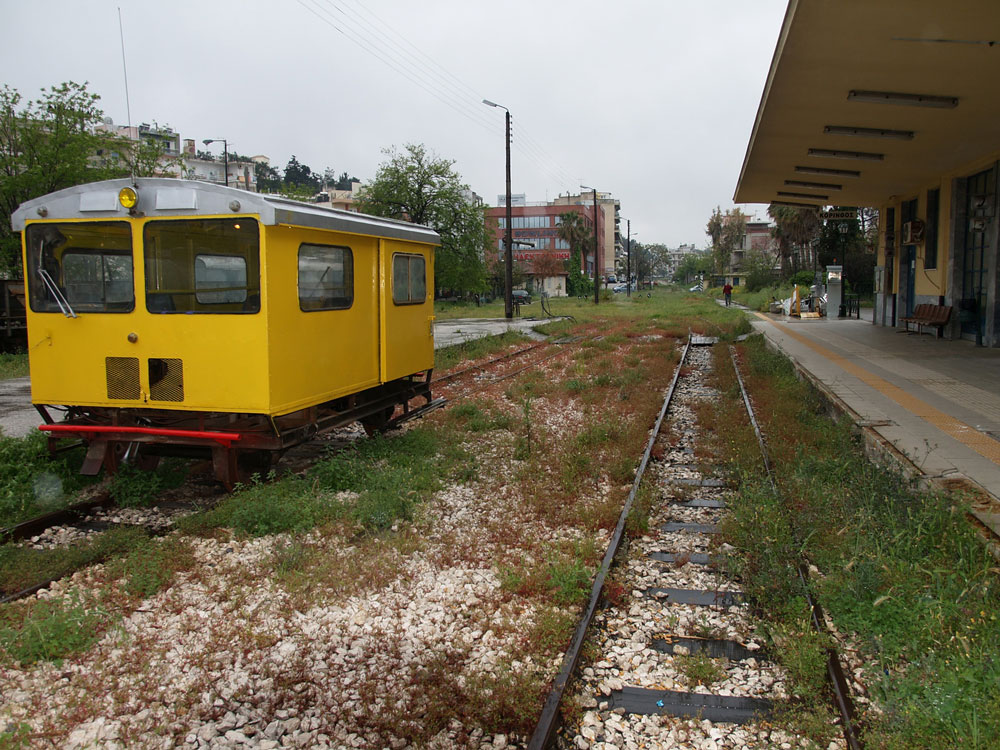
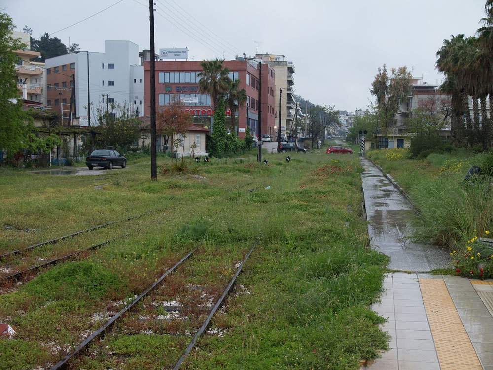
Further east,  the station at Narantza  has not been used in decades. I used to vacation near here, and from my sister’s house we would hear the trains periodically rumble by. One engineer was distinctive because he tooted the horn more than other train drivers. Continuing east, the train would have stopped in the city of Korinthos.

Then the train crosses the narrow Corinth Canal (Διώρυγα της Κορίνθου), which connects the Gulf of Corinth (Korinthiakos Kolpos) with the Saronic Gulf (Saronikos Kolpos). The canal, dug in the 1890s, is narrow and mostly used by cruise boats.

img360_Athens_RRsta_970715_corrected_resize_web

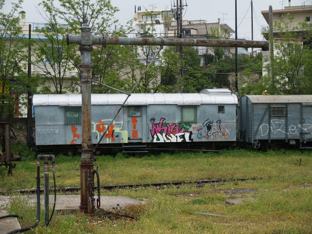
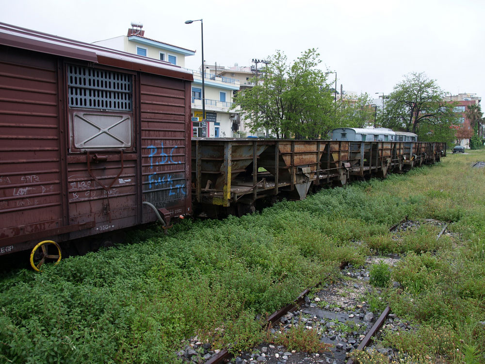
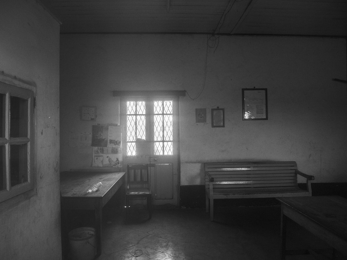
Finally, after chugging through the industrial suburbs of west Athens, we reached the Peloponnese Railroad Station on Sidirodromon Street (built in 1889). It was pretty sleepy in 1997 and some men were sitting around playing backgammon and drinking coffee (Greek gents do a lot of this). I think the station is now unused and am not sure what its fate will be.

(This is Part 2 of a two part article on the Railways of Greece. Click here to read Part 1)

Andrew Morang – Photographs and text Copyright 2016
See more of Andrew’s work at his blog, Urban Decay.

Railways of Greece
 Part 1

P4271862_RR_Sta_Korinthos__110427_resize_web
The Athens to Peloponnese Railroad Station
Corinth, Greece

The Piraeus, Athens and Peloponnese Railways or SPAP (in Greek: Σιδηρόδρομοι Πειραιώς-Αθηνών-Πελοποννήσου or Σ.Π.Α.Π.) was founded in 1882 to connect the port of Piraeus (Πειραιεύς) with Athens and the Peloponnese region of southern Greece. The late-1800s was the era of great railroad building throughout the world. Greece, at that time a poor nation with isolated market towns and limited roads, hoped to support economic development by building a rail system. The Peloponnese line reached Corinth in 1885 and Patras in 1887. SPAP was absorbed by the Hellenic State Railways in 1962, now called OSE (Greek: Οργανισμός Σιδηροδρόμων Ελλάδος or Ο.Σ.Ε.). The Peloponnese rail was 1,000 mm (3 ft 3 ⅜ in.) narrow-gauge, in contrast to the continental-standard 1,435 mm (4 ft 8 ½ in.) used in most of mainland Greece. The line from Piraeus to Corinth was 99 km long. In the 1890s, it was the fastest way to make the journey, the alternate being a steamship trip.

Corinth-map

The map shows the location (background street map from ESRI maps and data). During the mid-20th century, tourists arriving from Italy typically took a ferry boat from one of the Italian Adriatic ports to the city of Patras, where they disembarked. Then the SPAP train took them on a leisurely day-long ride to the old central rail station in Athens. Once the modern highway was built in the 1960s, many travelers took diesel buses instead. As a result, they rushed past the charming little market towns clustered along the shore of the Gulf of Corinth and missed the train experience.

P4271858_RR_Sta_Korinthos__110427_resize_web

Today, the rail station in Corinth on Dimokratias Street stands semi-abandoned. As of 2005, the modern suburban rail connects the Athens Elefthérios Venizélos (Ελευθέριος Βενιζέλος) International Airport with Corinth and, now continues further west to the town of Kiato. Eventually, the modern rail will extend all the way to Patras, and the rest of the historic narrow gauge train will be discontinued.

P4271856_RR_Sta_Korinthos__110427_resize_web

P4271860_RR_Sta_Korinthos__110427_resize

P4271857_RR_Sta_Korinthos__110427_resize

This station looks like it is late-1940s or 1950s-vintage. Corinth was badly damaged by an earthquake in 1928, and possibly that eventually necessitated a new station. Another hypothesis: The railroad suffered extensive damage during the second World War, and maybe the original station was damaged.

P4271855_RR_Sta_Korinthos__110427_resize_web

P4271859_RR_Sta_Korinthos__110427_resize_web

In 2011, the rail yard was pretty quiet, with abandoned rolling stock sitting on sidings. The arm sticking out in front of a graffiti-covered box car is an old water tap for filling the tenders of steam locomotives.

P4271861_RR_Sta_Korinthos__110427_resize_web

Finally, these mechanical control units actuated track switches. Oddly, they were on the platform in front of the station waiting room. Wouldn’t tourists be tempted to fiddle with them? It’s strange they had never been electrified or adapted to control from a central control room.


The Kalávryta Narrow-Gauge Rack Railroad
Peloponnese, Greece

Kalavryta-map_web

The Kálavrita (Καλάβρυτα) Railway was engineered by an Italian company in 1885-1895 in the fantastic gorge of the Vouraikós River. The original steam locomotives are long gone and have been replaced with modern diesel-electric cars, but nothing detracts from the magnificent scenery or from the achievement of the engineers some 120 years ago. The route starts in the coastal town of Dhiakftó and proceeds south (uphill) through the gorge to a high fertile plateau. Kalávryta is in the East Central part of the prefecture of Achaea. You can drive there through the mountainous and scenic Peloponnese, but many people opt to park their car at Dhiakftó and take the famous train for a day-long excursion.

IMG053_Kalavryta-RR-sta_820413_resize_web

This is the station in Kalávryta (2480 ft altitude). Although in use on weekends, it is pretty quiet and has a lost-in-time look to it. The town is historically noteworthy for two events. First, at the nearby Monastery of Ayia Lávra, Germanos, the Bishop of Patras, raised the flag of revolution against the occupying Turks on March 21, 1821. This eventually led to Greek Independence. The second event is more tragic. On December 13, 1943, German occupying troops massacred 1436 males over the age of 15 and burnt the town (from Blue Guide Greece, 1973 edition).

Morang_1982_004_adj_resize_web

Here are the young beauties in the old rail car.

P4251816_Kalavrita_RR_110425_resize_web

DSCF0282_KalavritaRR_080430_resize_web

P4251815_Kalavrita_RR_110425_resize_web

Zachloroú is the first stop north of Kalávryta, where many people get off the train and hike downhill through the gorge. In my case, I took a taxi from the coast to this station to begin the hike. The route is part of the E4 European long distance hiking path (if you are really energetic, you can walk the E4 from Tarifa, the southernmost point of mainland Spain, to Crete!). There are two tavernas right at the edge of the rail line. One of them specializes in delicious roasted rooster and local retsina, where you can fortify yourself with calories in preparation for the 4-hr trek. One of the nice things about travel in Greece is that even small rural places prepare amazingly good food. There is also a nice little hotel if you want to stay the night (perhaps you had too much retsina…).

P4251817_Kalavrita_RR_110425_resize_web

P4251814_Kalavrita_RR_110425_resize_web

DSCF0286_KalavritaRR_080430_resize_web

As you proceed downhill, you pass stone work sheds and water tanks, which have been restored and painted. The Ο.Σ.Ε. must have put a lot of money into the project.

All the track was replaced in 2008-2010. From Wikipedia: “The railway is single line with 750 mm (2 ft 5½ in) gauge. It climbs from sea level to 720 m in 22.3 km with a maximum gradient of 17.5%. There are three sections with Abt system rack for a total of 3.8 km. Maximum speed is 40 km/h for adhesion sections and 12 km/h for rack sections.” The total route is 33 km.

The gorge gets more and more rugged, and you wonder how the engineers managed to tunnel and bridge their way up this valley. What ambition. The tunnels are interesting because you need to be sure you are not in one when the train comes. The first time I walked the route in 2008, the system was closed while the tracks were being replaced, but the next time, I had to remember to look for the train. It’s really not a problem except for the bridges and tunnels.

Finally, as you approach the coastal plain, the gradient levels out and you have an easy walk to the depot in Dhiakftó. The geology is also fascinating, and you pass through regions of conglomerate, sandstone, limestone, and alluvial outwash.

P4251824_Kalavrita_RR_110425_resize_web

P4251825_Kalavrita_RR_110425_resize_web

At Dhiakftó, the excursion train meets the main Athens-Peloponnese line (also narrow-gauge). A new full-gauge rail is being built to connect to Patras, but I do not know if the new line will come to this rail yard or be routed further inland.

(This is Part 1 of a two part article on the Railways of Greece. Be sure to check back next Thursday for Part 2)

Andrew Morang – Photographs and text Copyright 2016
See more of Andrew’s work at his blog, Urban Decay.

Railroad Town:
 Bude, Mississippi

Bude_2_P4175
Bude, Mississippi

During a visit to Mississippi in the spring of 2013, I visited the small, out of the way, town of Bude which is about halfway between Brookhaven, MS and Natchez, MS. Bude was once a bustling railroad town built around a large sawmill. Today there is not much left but a sleepy main street and the old train depot.

Bude_P4179
Former Mississippi Central Depot, Bude Mississippi

The Natchez Railway, which provides service between Natchez and Brookhaven, passes through Bude and interchanges with the Canadian National in Brookhaven.

Bude_P4149
Former Illinois Central Gulf caboose 9452, built in 1970, was used as the yard office in Gloster, Mississippi for the Gloster Southern Railroad. It was moved to Bude in 2011 and is used as the Natchez Railway yard office.
History of Bude
From Depot, Bude, Miss. Sysid 92294. Scanned as tiff in 2008/11/03 by MDAH. Credit: Courtesy of the Mississippi Department of Archives and History
Depot, Bude, Mississippi – Courtesy of the Mississippi Department of Archives and History

Founded in February, 1912 the Homochitto Lumber Company bought up vast tracts of timber in Franklin, Amite and Adams counties and selected a mill site in Franklin county. The town of Bude grew up around the new mill, which employed 800 people when it opened in 1913.  The town continued to grow, attracting many businesses and stores including a Ford dealership, a theater, and a bowling alley. In 1936, the timber was cut out, the sawmill closed and Bude began its long decline.

The historic photos below are used with the kind permission of Mississippi Rails, a website devoted to the history of railroads in Mississippi. Many additional period photographs and a detailed history of Bude and the sawmill are available on their Homochitto Lumber Company page.

Homochitto-3
A passenger train arrives at the Mississippi Central depot in Bude.
Homochitto-9
The mill, the depot and the town of Bude from the air in 1920.

After the Homochitto Lumber Company closed down in 1936, the town of Bude was deprived of its primary source of employment and prosperity. It was not unusual for towns to spring  up and then disappear as vast tracts of cypress and southern yellow pine in the Southern Timber Belt were logged.

Bude fared better than many former sawmill towns. Today there are still a few stores along Bude’s main street and the town is neat and well maintained. American Railcar Industries operates a repair facility in Bude.

Although the Homochitto Lumber Company brought Bude into existence in 1913, the railroad was a necessary ingredient in the town’s success and the railroad plays a key role in sustaining the town into the 21st century. Photographs from the early years of the 20th century are a stark contrast to a modern view of the town, but the railroad still runs through Bude, and the depot still stands as a reminder of better days.

An old freight wagon waits in the shadow of the empty depot.

Edd FullerPhotographs and text Copyright 2016


Last Train to Arusha

Railroad station, Arusha, Tanzania

Dear Readers, sorry, the title is a bit deceptive. There are no trains to Arusha, and I think the last one left the station at least a decade ago. Arusha is a bustling commercial city in north central Tanzania. Most western visitors know it as a gateway to safaris in the Tanzanian game parks or as a gathering point before a climb of Kilimanjaro. Arusha itself does not offer much for the tourist, but it is busy, noisy, and colorful.

Railroad station, Arusha, Tanzania

The railroad was built in the early 20th century, during the great era of railroad-building around the world. The official Tanzanian railroad web page states, “Construction of the 86.08 km Moshi-Arusha railway extension of the Tanga Line starting at Moshi in 1911 and reaching Arusha in 1929. The railway distance from Arusha to Tanga and Dar es Salaam is 437km and 644km respectively.” My guide, Morris, said the railroad was built by the Germans. He was partly correct because while the Germans were forced out of their African colonies in World War I, they certainly began the construction project when Tanzania was part of German East Africa. According to Wikipedia, Germany controlled this part of east Africa from the 1880s to 1919, when, under the League of Nations, it became a British mandate.

Railroad station, Arusha, Tanzania

On my first day in Arusha, I asked Morris to take me to the train depot. He was surprised, and said he had never had a tourist ask him to go there. We took rides with rent-a-motorbike transport guys. Mine had a spare helmet and was very careful, avoiding the rain gutters that line most of the roads. Some of these are serious troughs, about a meter deep and lined with organic debris of unknown aromatic origin. The depot buildings are in a warehouse part of town. Lorries were parked in the dust.

Railroad station, Arusha, Tanzania

The buildings were intact and secure, so someone still takes responsibility.

Railroad station, Arusha, Tanzania

The tracks were meter gauge, another remnant of the German origins for this project.

Railroad station, Arusha, Tanzania

Notice there was once first and second class on the train.

Railroad station, Arusha, Tanzania

Some gents were sitting at one of the platforms. Morris asked them if I could take their portrait. They said they did not see many white people (Westerners?) around there.

Railroad station, Arusha, Tanzania

Railroad station, Arusha, Tanzania

It was pretty sleepy on the track side of the depot. The bugs were buzzing, the sun blazing – time for a nap.

Railroad station, Arusha, Tanzania

Railroad station, Arusha, Tanzania

There was not much happening inside, either. The buildings are locked, so someone has possession. I hope they can one day restore train service.

Railroad station, Arusha, Tanzania

Andrew Morang – Photographs and text Copyright 2016

See more of Andrew’s work at his blog, Urban Decay.

Standing Tall

Sanford, North Carolina

Today this noteworthy freight depot is frail, yet still standing tall. It was originally built for the Atlantic Coast Line Railroad, either at the end of the 19th century or shortly thereafter. It stands just south of the brick, 1910 Union Station at the rail crossover of the Atlantic Coast Line and the Seaboard Airline Railroad in Sanford, NC.

IMG_3769

During the first quarter of the 20th century, Sanford was blessed with four railroads converging at the same location; the Seaboard, the Southern, the Atlantic Coast Line and the Atlantic and Western railroads. At that time the town was bursting with commerce more than 50 years after the Civil War.

Presently the freight depot is used for the storage of signal equipment for the Atlantic and Western and CSX railroads. The exact date of the wood frame construction is not known. However, there are pictures of several other freight depots along the line of the Atlantic Coast Line that are of similar shape, dimension and detail. Rumor has it that a roving, gifted black contractor was responsible for their construction.  A wood or coal fired stove used as a heat source was connected to a chimney strategically located at the one-third point of the roof  on all of the floor plans. The generous overhangs supported by large brackets on the east and west elevations are quite distinctive. Evidently the train loading platform was located on the east side while the truck loading activity occurred on the west side. During its later life the structure was expanded to the south until it reached the former Sanford Sash and Blind Company that has since been abandoned. Hence, the change in roof treatment.

IMG_3816

The only question that remains unresolved is why the northwest roof corner was clipped off later in life. My guess is that when CSX absorbed the Seaboard it wanted to maintain its ROW air rights. Nevertheless, in spite of its present physical condition, the hope is that the community will see fit to save this significant landmark that played an important role in the development of a major transportation hub in the center point of North Carolina.

David Kahler – Photographs and text Copyright 2016

Birthday Finest

The town of New Canaan, Connecticut was established in 1731, and was an agricultural community with a few small shoe making businesses. Then in 1868, the expanding New Haven Railroad built a branch line of 7.9 miles from the Stamford Main Line to connect New Canaan with the outside world. At the time, the post-civil war population was 2,497. Fast forward one hundred years to 1968, and the population had grown to around 17,100, and the town was becoming an affluent and sought after place for New York executives to live with a 70 minute commute between home and work.

Although the New Haven Railroad in 1968 was in dire physical and financial condition, the centennial of the New Canaan Branch could not go unrecognized, so the town and the railroad decided to celebrate appropriately. The station building was spruced up with new paint, and for the weekend the New Haven sent two of their freshly repainted freight engines up to town to be on display for the locals to see.

Main Station - New Canaan, Connecticut - 1968
Main Station – New Canaan, Connecticut – 1968

The railroad definition of a station is “a place named in the timetable”. Nothing more. It can be just a sign, or an architecturally grand structure for a big city. Within the town of New Canaan, there is another station – Talmadge Hill. This little station was originally just one step above a flag stop in stature; all the trains stopped there, but usually only a few hardy passengers got on or off.

Although it was tiny, the railroad’s Bridge and Building painters decided Talmadge Hill was deserving of a centennial celebratory sprucing up as well, so after dressing up New Canaan, they used a couple of gallons of paint to spruce up the station building.

On this day, the little building is resplendent and proud, all dressed up in birthday finest and ready to shelter any waiting passengers from the rain. Even the sign is new, announcing to everyone that Talmadge Hill Station is ready and able to serve.

Talmadge Hill Station - New Canaan, Connecticut - 1968
Talmadge Hill Station – New Canaan, Connecticut – 1968

A great deal has changed since I took this photo in 1968. In those days, the morning newpapers for the commuters were left on a bench inside the station. Alongside was an unlocked metal box, which held the nickels and dimes left by the commuters, strictly on the honor system. The following day the agent returned in the early hours with the next days papers and collected the coins from the day before.

In 1971, the station building was demolished and replaced by high level platforms, fixed seating, and lighting, and new train cars. Today, the hundreds of commuters who park in several lots surrounding the station, probably have no idea that Talmadge Hill is nearing it’s 150th birthday, but never as well dressed as it was in 1968.

Bob HughesPhotographs and text Copyright 2016